19 Castleridge CourtNarre Warren South VIC 3805

Thinking about insurance?
Get estimated rebuild costs for this property with Sum SureProperty Details for 19 Castleridge Ct, Narre Warren South
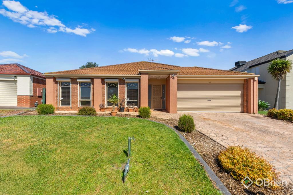
19 Castleridge Ct, Narre Warren South is a 4 bedroom, 2 bathroom House with 2 parking spaces and was built in 2001. The property has a land size of 600m2 and floor size of 182m2. While the property is not currently for sale or for rent, it was last sold in April 2015.
Last Listing description (February 2016)
Welcome to your new home, where all you have to do is unpack and starting living! This immaculate brick residence is perfect for family life with two spacious living areas, zoned bedrooms and two bathrooms. The spacious kitchen is central to the home and offers plenty of cupboard space plus stainless steel appliances including dishwasher. An ensuite accompanies the master bedroom along with a walk in robe, the remaining three bedrooms all have built in robes. Low maintenance gardens surround the home where your focus can be on entertaining family and friends whilst watching the kids play in the spacious rear yard. Other bonuses include a double garage, a study, ducted heating, evaporative cooling and split system air-conditioning. Located in the Hillsmead Estate this fabulous family home is within walking distance to the Hillsmead Primary School, Alkira Secondary College, shops and public transport. Make an appointment to see your new home today!
Property History for 19 Castleridge Ct, Narre Warren South, VIC 3805
- 24 Apr 2015Sold for $482,000
- 10 Apr 2015Listed for Sale $465,000 PLUS BUYERS
- 03 Feb 2007Sold for $300,000
Local Area Liveability Score
This Liveability Score is a rating "out of 10" and a guide to how well connected properties within a local area are to facilities such as public transport, healthcare services, shopping outlets, schools and parkland. The scores apply to the local area (or "mesh block") in which a property is located. The scores are largely comprised of 2 main elements:
- Walking time to a local facility
- Number of facilities within a 20-minute walk
The overall Liveability Score is made up of smaller sub-scores, as described below.
Recent sales nearby
See more recent sales nearbySimilar properties For Sale nearby
See more properties for sale nearby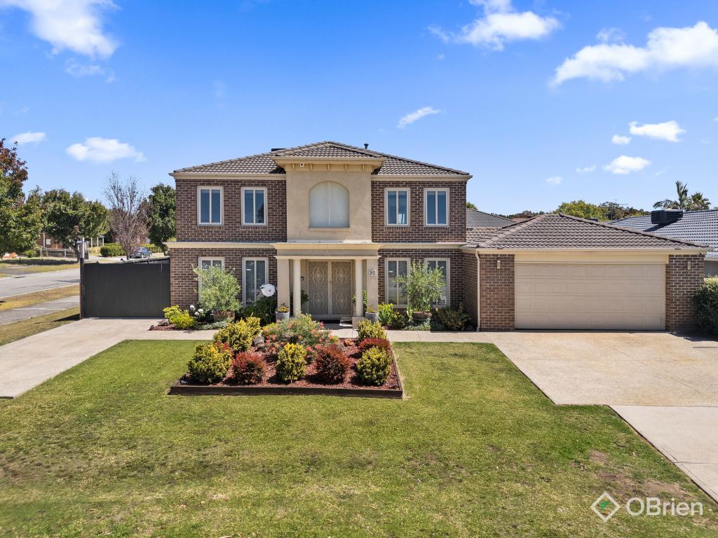


Similar properties For Rent nearby
See more properties for rent nearby

About Narre Warren South 3805
The size of Narre Warren South is approximately 13.1 square kilometres. It has 44 parks covering nearly 12.6% of total area. The population of Narre Warren South in 2011 was 28,595 people. By 2016 the population was 30,299 showing a population growth of 6.0% in the area during that time. The predominant age group in Narre Warren South is 10-19 years. Households in Narre Warren South are primarily couples with children and are likely to be repaying $1800 - $2399 per month on mortgage repayments. In general, people in Narre Warren South work in a trades occupation. In 2011, 84.9% of the homes in Narre Warren South were owner-occupied compared with 82.6% in 2016.
Narre Warren South has 9,954 properties. Over the last 5 years, Houses in Narre Warren South have seen a 29.00% increase in median value, while Units have seen a 14.24% increase. As at 28 February 2025:
- The median value for Houses in Narre Warren South is $862,853 while the median value for Units is $587,745.
- Houses have a median rent of $605 while Units have a median rent of $510.
What's around 19 Castleridge Ct, Narre Warren South
19 Castleridge Ct, Narre Warren South is in the school catchment zone for Hillsmeade Primary School and Alkira Secondary College.


Suburb Insights for Narre Warren South 3805
Market Insights
Narre Warren South Trends for Houses
$863k
0.28%
View Trend$605/W
3.94%
Narre Warren South Trends for Units
$588k
-9.30%
View Trend$510/W
4.41%
Neighbourhood Insights
Age
Population 30,299
0-9
16%
10-19
18%
20-29
13%
30-39
14%
40-49
17%
50-59
12%
60-69
7%
70-79
3%
80-89
1%
Household Structure
Occupancy
© Copyright 2025 RP Data Pty Ltd trading as CoreLogic Asia Pacific (CoreLogic). All rights reserved.
This product uses cookies and other similar technologies to improve and customise your browsing experience, to tailor content and adverts, and for analytics and metrics regarding visitor usage on this product and other media. We may share cookie and analytics information with third parties for the purposes of advertising. By continuing to use our website, you consent to cookies being used. View our Privacy Policy here.
X