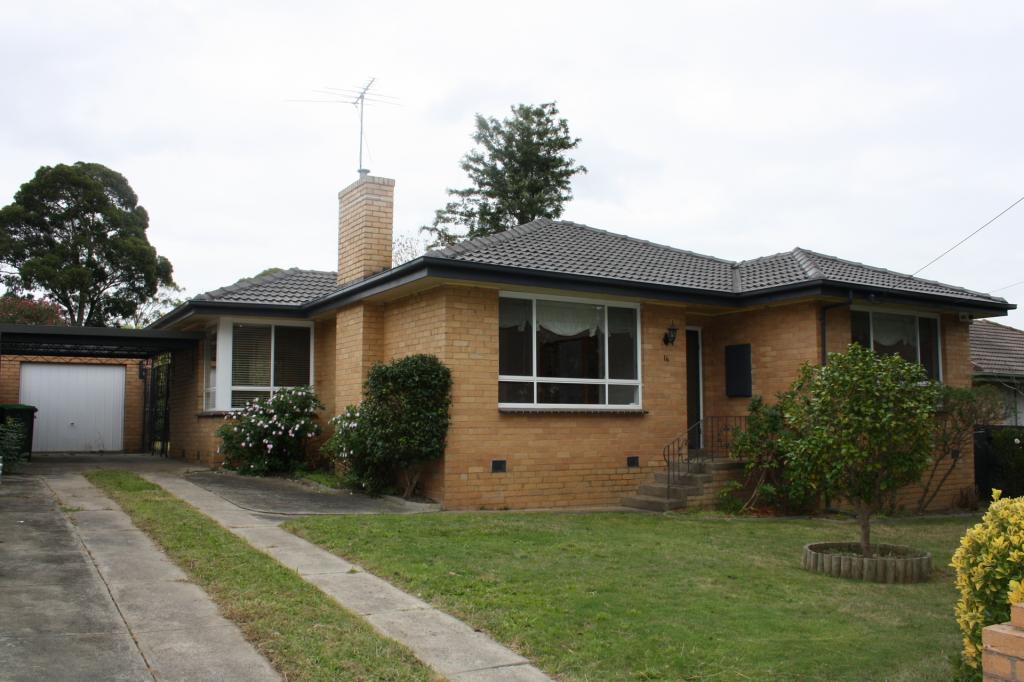
227 Springfield RoadBlackburn North VIC 3130

Property Details for 227 Springfield Rd, Blackburn North
227 Springfield Rd, Blackburn North is a 2 bedroom, 1 bathroom Unit with 1 parking spaces and was built in 1998. While the property is not currently for sale or for rent, it was last sold in October 1996.
Last Listing description (June 2019)
Low Maintenance Living in Prime Location
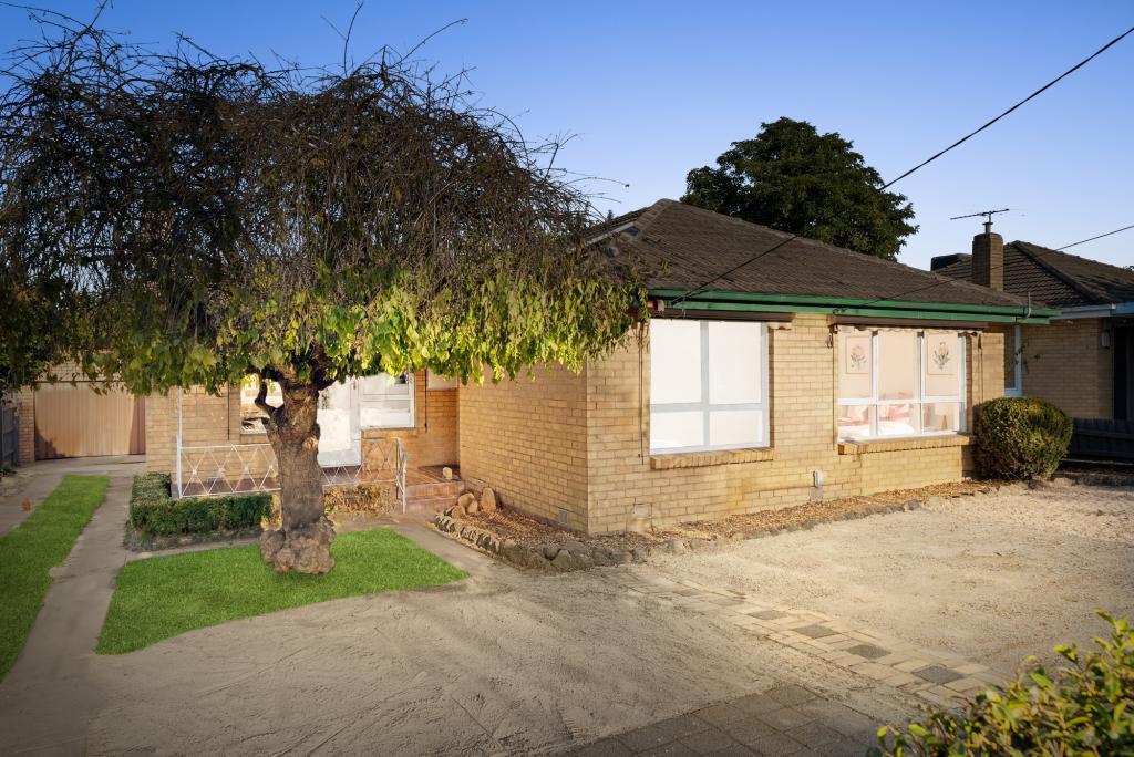
Cute two bedroom home on a compact low maintenance allotment. Offering terracotta tiled entry, expansive carpeted lounge with feature only non-functional fire place, ceiling fan and carpeted separate dining room with ceiling fan and air conditioning unit. Updated kitchen includes gas cooktop, electric oven and dishwasher with tiled meals area and walk in pantry, two carpeted bedrooms, master bedroom with lovely bay window and built in robes and second bedroom with mirrored built in robes. Modern central bathroom with shower, vanity and bath, separate tiled laundry with ample storage space and separate toilet.
We highly recommend registering for an open for inspection. If the registered time is not suitable please click Book an Inspection or Contact Agent. Registering for an inspection will allow us to notify you by sms of any changes to open times and available dates as these are subject to change without notice. Photo Identification is required at all inspections.
- Air conditioning unit to living area
- Stunning pergola for entertaining
- Garden maintenance included for mowing and general pruning
Property History for 227 Springfield Rd, Blackburn North, VIC 3130
- 22 May 2019Listed for Rent - Price not available
Local Area Liveability Score
This Liveability Score is a rating "out of 10" and a guide to how well connected properties within a local area are to facilities such as public transport, healthcare services, shopping outlets, schools and parkland. The scores apply to the local area (or "mesh block") in which a property is located. The scores are largely comprised of 2 main elements:
- Walking time to a local facility
- Number of facilities within a 20-minute walk
The overall Liveability Score is made up of smaller sub-scores, as described below.
Recent sales nearby
See more recent sales nearbySimilar properties For Sale nearby
See more properties for sale nearby
Similar properties For Rent nearby
See more properties for rent nearby
About Blackburn North 3130
The size of Blackburn North is approximately 2.7 square kilometres. It has 11 parks covering nearly 6.5% of total area. The population of Blackburn North in 2011 was 7,027 people. By 2016 the population was 7,468 showing a population growth of 6.3% in the area during that time. The predominant age group in Blackburn North is 40-49 years. Households in Blackburn North are primarily couples with children and are likely to be repaying $1800 - $2399 per month on mortgage repayments. In general, people in Blackburn North work in a professional occupation. In 2011, 79.1% of the homes in Blackburn North were owner-occupied compared with 76.6% in 2016.
Blackburn North has 3,356 properties. Over the last 5 years, Houses in Blackburn North have seen a 10.67% increase in median value, while Units have seen a 26.76% increase. As at 28 February 2025:
- The median value for Houses in Blackburn North is $1,321,124 while the median value for Units is $869,523.
- Houses have a median rent of $625 while Units have a median rent of $580.
What's around 227 Springfield Rd, Blackburn North
227 Springfield Rd, Blackburn North is in the school catchment zone for Whitehorse Primary School and Blackburn High School.


Suburb Insights for Blackburn North 3130
Market Insights
Blackburn North Trends for Houses
$1.32M
-0.58%
View Trend$625/W
2.58%
Blackburn North Trends for Units
$870k
-3.15%
View Trend$580/W
3.60%
Neighbourhood Insights
Age
Population 7,468
0-9
14%
10-19
14%
20-29
11%
30-39
14%
40-49
16%
50-59
12%
60-69
8%
70-79
7%
80-89
5%
90-99
1%
Household Structure
Occupancy
© Copyright 2025 RP Data Pty Ltd trading as CoreLogic Asia Pacific (CoreLogic). All rights reserved.
This product uses cookies and other similar technologies to improve and customise your browsing experience, to tailor content and adverts, and for analytics and metrics regarding visitor usage on this product and other media. We may share cookie and analytics information with third parties for the purposes of advertising. By continuing to use our website, you consent to cookies being used. View our Privacy Policy here.
X