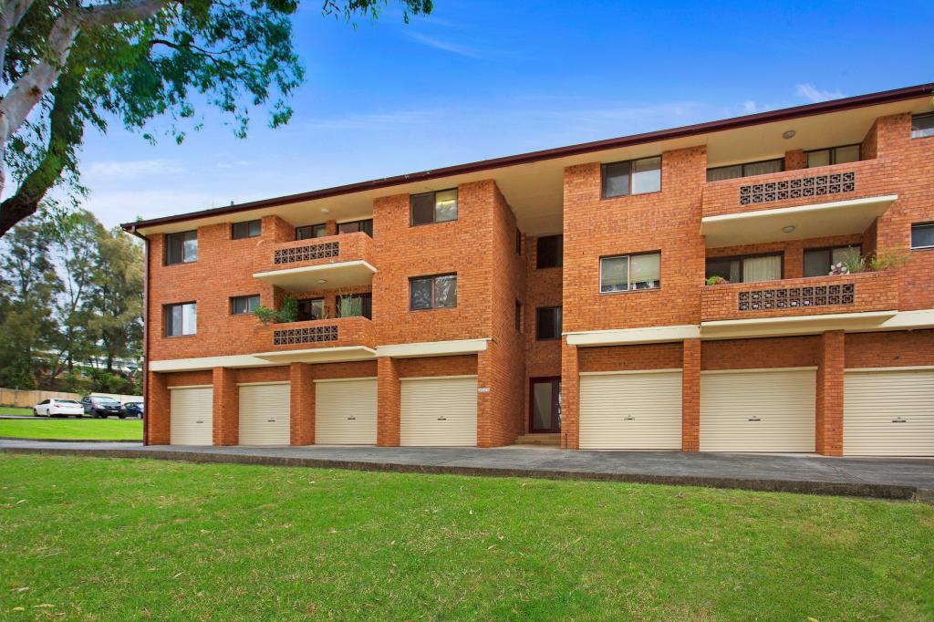
15/80 South Kiama DriveKiama NSW 2533
Property Details for 15/80 South Kiama Dr, Kiama
15/80 South Kiama Dr, Kiama is a 2 bedroom, 1 bathroom Unit with 1 parking spaces and was built in 2008. The property has a land size of 169m2 and floor size of 132m2. While the property is not currently for sale or for rent, it was last sold in December 2024. There are 36 other 2 bedroom Units sold in Kiama in the last 12 months.
Last Listing description (February 2025)
Experience comfort, style, and ease in this spacious single-level villa, crafted for retirees or those seeking a relaxed, low-maintenance lifestyle. In this boutique complex, you'll become part of a vibrant, connected and welcoming community if you wish.
What we love:
Two well-appointed bedrooms with built-in wardrobes
Open-plan kitchen, living, dining and sitting area flowing onto a private east-facing sunroom
Year-round comfort with air conditioning, ceiling fans and a gas bayonet
Secure single garage plus an additional open car space included on the title
Additional versatile sitting room, ideal as an office or hobby room, opening to a small garden feature
Located near Kendalls Beach, Easts Beach and essential local amenities, this villa presents a prime opportunity for a low-maintenance, enjoyable lifestyle. To discover the joy of easy living contact Matthew Lay at 0448 440 609 or Katelyn Liu at 0424 281 136 today to arrange your inspection.
Please Note: Parking for open homes is available on South Kiama Drive.
Property History for 15/80 South Kiama Dr, Kiama, NSW 2533
- 19 Dec 2024Sold for $773,000
- 14 Nov 2024Listed for Sale Price Guide $770,000 - $830,000
- 06 Mar 2008Sold for $385,000
Recent sales nearby
See more recent sales nearby

Similar properties For Sale nearby
See more properties for sale nearby


Similar properties For Rent nearby
See more properties for rent nearby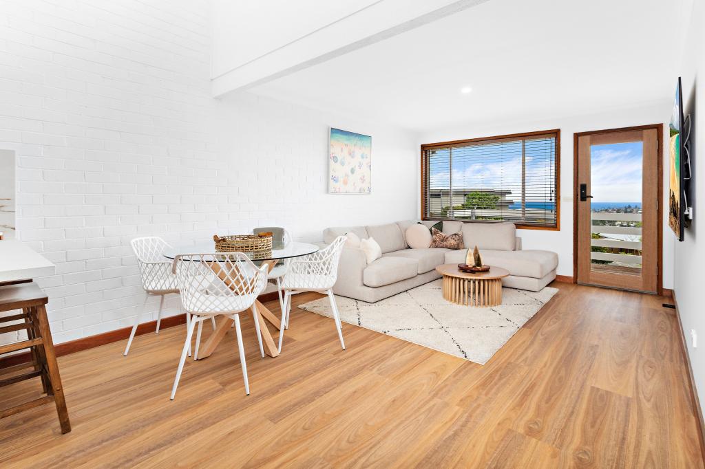
About Kiama 2533
The size of Kiama is approximately 10 square kilometres. It has 27 parks covering nearly 7.6% of total area. The population of Kiama in 2011 was 6,272 people. By 2016 the population was 6,900 showing a population growth of 10.0% in the area during that time. The predominant age group in Kiama is 60-69 years. Households in Kiama are primarily childless couples and are likely to be repaying $1800 - $2399 per month on mortgage repayments. In general, people in Kiama work in a professional occupation. In 2011, 68.5% of the homes in Kiama were owner-occupied compared with 71.2% in 2016.
Kiama has 5,152 properties. Over the last 5 years, Houses in Kiama have seen a 67.19% increase in median value, while Units have seen a 45.78% increase. As at 28 February 2025:
- The median value for Houses in Kiama is $1,538,995 while the median value for Units is $899,049.
- Houses have a median rent of $730 while Units have a median rent of $620.
What's around 15/80 South Kiama Dr, Kiama
15/80 South Kiama Dr, Kiama is in the school catchment zone for Kiama High School and Kiama Public School.


Suburb Insights for Kiama 2533
Market Insights
Kiama Trends for Houses
$1.54M
-0.23%
View Trend$730/W
2.50%
Kiama Trends for Units
$899k
0.29%
View Trend$620/W
3.68%
Neighbourhood Insights
Age
Population 6,900
0-9
9%
10-19
11%
20-29
9%
30-39
9%
40-49
12%
50-59
14%
60-69
16%
70-79
13%
80-89
7%
90-99
2%
Household Structure
Occupancy
© Copyright 2025 RP Data Pty Ltd trading as CoreLogic Asia Pacific (CoreLogic). All rights reserved.
This product uses cookies and other similar technologies to improve and customise your browsing experience, to tailor content and adverts, and for analytics and metrics regarding visitor usage on this product and other media. We may share cookie and analytics information with third parties for the purposes of advertising. By continuing to use our website, you consent to cookies being used. View our Privacy Policy here.
X