4075 Boorolong RoadBoorolong NSW 2350
Property Details for 4075 Boorolong Rd, Boorolong
Last Listing description (March 2017)
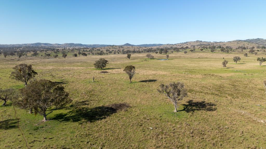
1684 hectares (4160ac) located 46km from the regional city of Armidale. This is undulating plateau country ranging between 900m and 1000m altitude. Safe water and very good structural improvements are features of the property. This is a reasonably large scale operation that can be managed and maintained quite easily.
Electricity and telephone is connected. Mail services 3 days per week. School bus (7.5km) to all Armidale schools. Daily air and rail services from Armidale to Sydney. Livestock selling facilities at Armidale and Guyra.
Soil type is traprock derivative with soft loamy soils located along the gullies and lower areas. Generally native pastures oversown with clovers and ryes. There is a long superphosphate history spanning over 40 of the last 50 years.
All the fences can be considered as stock proof. 25 main paddocks plus a 3.5km stock movement laneway through the property.
The property has previously carried in excess of 11000 DSE in a sheep/cattle mix. Currently running 9000 DSE. Obviously in drought years numbers have been reduced.
Improvements:
Homestead - Brick veneer/Tile, built 1990, spacious with 4 bedrooms (all with built-ins), study, open plan kitchen (Tassie Oak, all electric with gas cooktop) /dining /lounge, rumpus room, 2 bathrooms, large laundry, patios. Heating is by gas and wood fire. Set in an established garden with tennis court and in-ground saltwater chlorinated pool. Includes a 3 car shed with power and concrete floor. 52000 gals rainwater storage. 5000 gals bore water reservoir with automatic top-up system from Bore (60' deep and tested at 2000gal/hr) located 100 m from the home.
Woolshed - 4 stand Cyclone shed, built 1989, with skillion, all electric, sheds 700 sheep.
Shearers' Amenities - Single room steel construction with power and water.
Crutching Sheds - two situated at convenient locations
Silos - 3 x 30 tonne silos.
Cattle Yards - Timber & steel yards with cattle crush and calf cradle.
Sheep Yards - Three sheep yards strategically located. Main set is bugle design constructed of steel. Two other reasonably new sets of yards constructed of steel.
Airstrip - 700m grass strip in good condition.
Property History for 4075 Boorolong Rd, Boorolong, NSW 2350
- 10 Feb 2017Sold for $3,100,000
- 04 Apr 2016Listed for Sale $3,100,000
- 25 Feb 2004Sold for $2,250,000
Commute Calculator
Recent sales nearby
See more recent sales nearbyAbout Boorolong 2350
The size of Boorolong is approximately 278.2 square kilometres. It has 2 parks covering nearly 6.6% of total area. The population of Boorolong in 2011 was 185 people. By 2016 the population was 84 showing a population decline of 54.6% in the area during that time. The predominant age group in Boorolong is 50-59 years. Households in Boorolong are primarily couples with children and are likely to be repaying under $300 per month on mortgage repayments. In general, people in Boorolong work in a managers occupation. In 2011, 52.9% of the homes in Boorolong were owner-occupied compared with 82.1% in 2016..
Boorolong has 44 properties. As at 31 October 2024:
- The median value for Houses in Boorolong is $750,450.
Suburb Insights for Boorolong 2350
Market Insights
Boorolong Trends for Houses
N/A
N/A
View TrendN/A
N/A
Boorolong Trends for Units
N/A
N/A
View TrendN/A
N/A
Neighbourhood Insights
© Copyright 2024 RP Data Pty Ltd trading as CoreLogic Asia Pacific (CoreLogic). All rights reserved.

/assets/perm/k7ll7x5i24i63js5x4rysoy7ra?signature=767b3ebb5f4bc99e41927854102af9b9500a80916d16a74621bc2d62652989b7) 0
0 0
0

