SOLD
Are you the owner?
Sold on 30 Jul 2024 for $1,040,000

4525 Werribee Road
Wooroloo WA 6558

Bedrooms: 5
Bathrooms: 2
Car spaces: 8
Floor area: 100m2
Land area: 200457m2
Sold By
Jo Hallam
Real Estate Plus Chidlow
Save

Property Details for 4525 Werribee Rd, Wooroloo

4525 Werribee Rd, Wooroloo is a 5 bedroom, 2 bathroom House with 8 parking spaces and was built in 1955. The property has a land size of 200457m2 and floor size of 100m2. While the property is not currently for sale or for rent, it was last sold in July 2024. There are 4 other 5 bedroom Houses sold in Wooroloo in the last 12 months.

Building Type
House
Year Built
1955
Floor Size
100m2
Land Size
200457m2
Local Government
Mundaring
Lot/Plan
24/P018681

Last Listing description (September 2024)

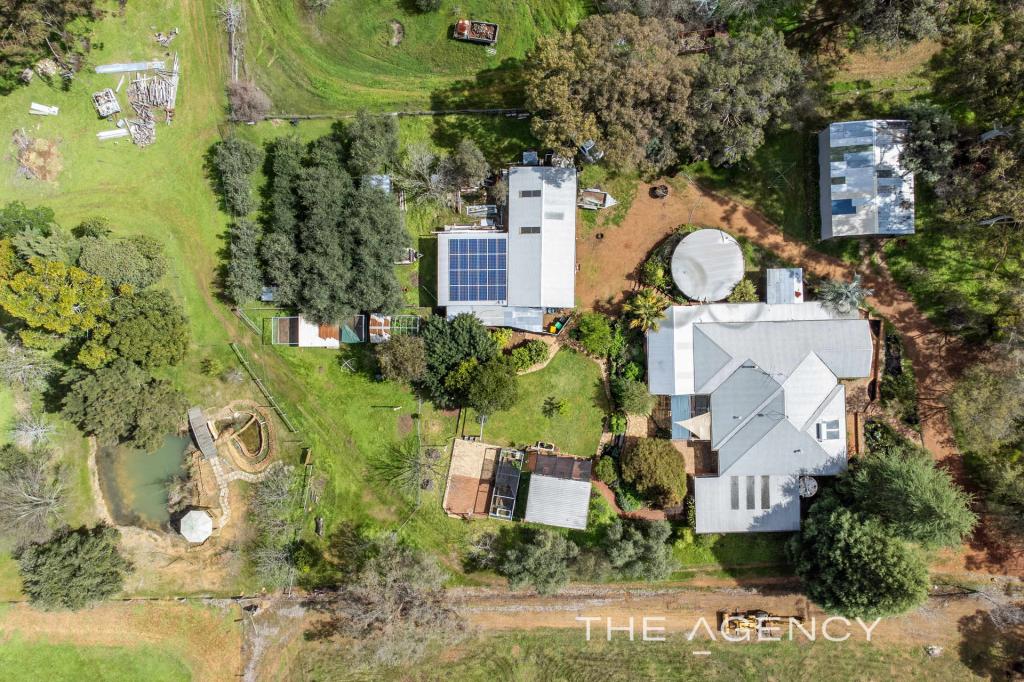
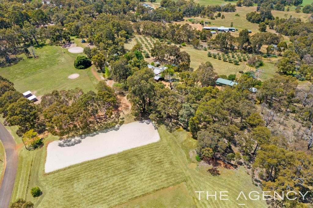
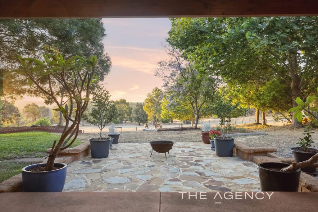
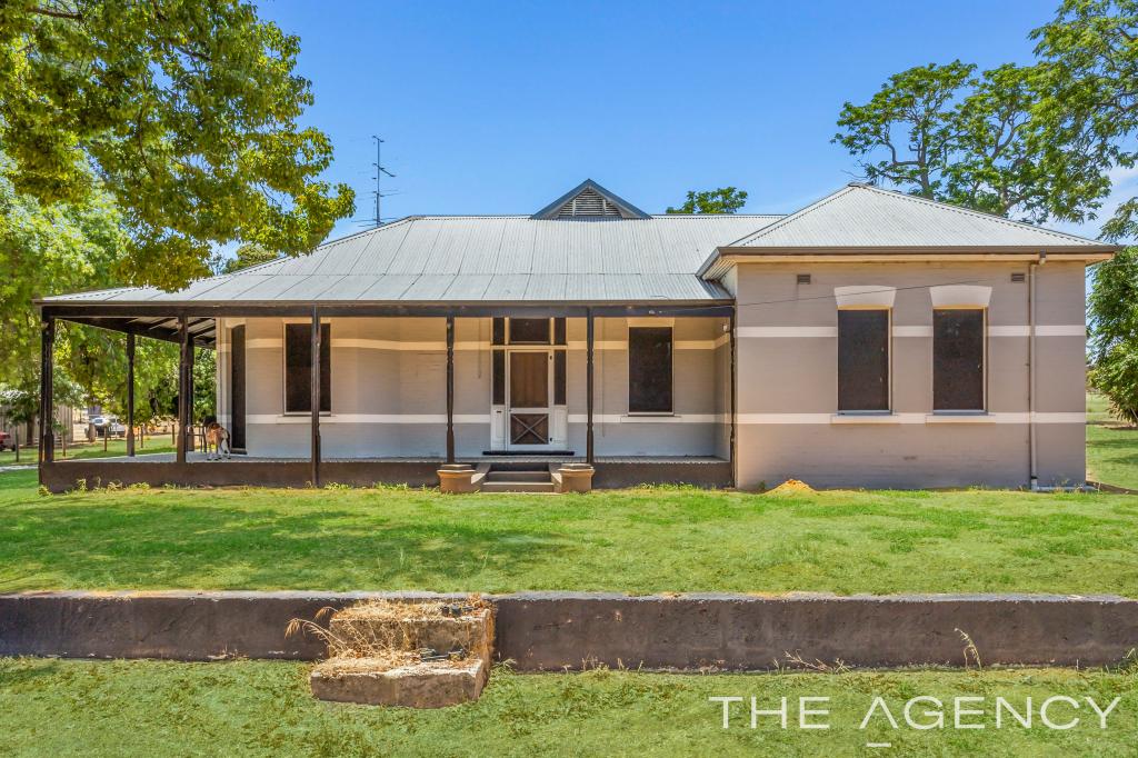
2 Homes, 50 Acres, Potential Income! - Motivated sellers - try an offer.Imagine sitting on your deck at the back of the property and looking at the view of your horses grazing on the undulating paddocks while you enjoy your evening meal. This well fenced property has been an equine property for many years which has evolved over time and has so much to offer to horse owners: Including extensive stabling, staff accommodation or extended family home, Store rooms, extra laundry, Tack rooms, Hay sheds, GP shed and more. Main home: Is a farmhouse with three bedrooms, a study or sewing room, Bathroom, Kitchen/dining, separate lounge, large laundry, back patio and extensive Jarrah deck at the front with a commanding view of the property. The home has been clad in Colorbond.Ancillary Dwelling: This is a brick building and has two bedrooms, a decent kitchen, dining area, lounge and large bathroom with laundry included.Both homes have a slow combustion heater and air conditioning. Both homes have carports.The garden of the main dwelling has been landscaped to include fruit trees, attractive shrubs, trees and vegie beds. A short walk away is the extensive stable complex which is mostly brick. There is a block of loose boxes, some suitable for stallions, a number of free standing brick loose boxes, 6 large brick walk in walk out shelters. Numerous paddocks, huge brick hay storage area, a Colorbond GP shed and more small sheds. There are also three old loose boxes that have been converted to rooms for storage, could be more tack and equipment rooms, all with power. There is a large solar panel system to help with the power bills, the property is on scheme drinking water. Wooroloo is a 20 minute drive to Mundaring and about 35 minutes to Midland. For unlimited riding simply cross straight over the road on to Railway heritage trail for riding. - Two homes on lovely 50 Acres Pasture- Extensive Stabling and Shelters- Plenty of Hay and Machinery Storage - Lots of Feed and Tack Room Areas- Auto Water Troughs to most Paddocks - Beautiful View from main Farm House- Would make a Great Agistment Centre or Riding School- Opposite Railway Heritage Trail

Property History for 4525 Werribee Rd, Wooroloo, WA 6558

A timeline of how this property has performed in the market
Last Sold
$1,040,000
30 Jul 2024
  • 30 Jul 2024
    Sold for $1,040,000
  • 19 Oct 2023
    Listed for Sale $1,050,000
  • 08 Jun 2003
    Listed for Sale Not Disclosed
Sign in to see more transactions

Commute Calculator

-
-
-
-

About Wooroloo 6558

The size of Wooroloo is approximately 47.5 square kilometres. It has 6 parks covering nearly 1.5% of total area. The population of Wooroloo in 2011 was 2,172 people. By 2016 the population was 2,669 showing a population growth of 22.9% in the area during that time. The predominant age group in Wooroloo is 30-39 years. Households in Wooroloo are primarily couples with children and are likely to be repaying $1800 - $2399 per month on mortgage repayments. In general, people in Wooroloo work in a trades occupation. In 2011, 84.2% of the homes in Wooroloo were owner-occupied compared with 87.3% in 2016.

Wooroloo has 439 properties.

    There are currently 6 properties listed for sale, and no properties listed for rent in Wooroloo on OnTheHouse. According to CoreLogic's data, 31 properties were sold in the past 12 months in Wooroloo.

    What's around 4525 Werribee Rd, Wooroloo

    4525 Werribee Rd, Wooroloo is in the school catchment zone for Eastern Hills Senior High School.

    Nearby Schools
    Comparable Properties
    Wooroloo Primary School
    1.67km
    Wooroloo 6558
    PrimaryGovernmentP - 6Combined67 Enrolled
    Wundowie Primary School
    6.72km
    Wundowie 6560
    PrimaryGovernmentP - 6Combined81 Enrolled
    Chidlow Primary School
    8.79km
    Address not found
    PrimaryGovernmentP - 6Combined154 Enrolled
    Gidgegannup Primary School
    11.77km
    Gidgegannup 6083
    PrimaryGovernmentP - 6Combined236 Enrolled
    Eastern Hills Senior High School
    13.11km
    Mount Helena 6082
    IN CATCHMENTSecondaryGovernment7 - 12Combined921 Enrolled
    Mount Helena Primary School
    13.3km
    Mount Helena 6082
    PrimaryGovernmentP - 6Combined210 Enrolled
    Bible Baptist Christian Academy
    13.59km
    Mount Helena 6082
    CombinedNon-GovernmentP - 12Combined22 Enrolled
    Bakers Hill Primary School
    14.11km
    Bakers Hill 6562
    PrimaryGovernmentP - 6Combined156 Enrolled
    Sawyers Valley Primary School
    16.44km
    Address not found
    PrimaryGovernmentP - 6Combined185 Enrolled
    Mundaring Christian College
    17.66km
    Mundaring 6073
    PrimaryNon-GovernmentP - 12Combined410 Enrolled

    Suburb Insights for Wooroloo 6558

    Market Insights
    Trends for Houses
    Median Value

    N/A

    -
    View Trend
    Median Growth

    N/A

    View Trend
    Median Rent

    N/A

    -
    View Trend
    Rental Yield

    N/A

    -
    View Trend
    Median Value: The middle value of all properties across the geography based on the Automated Valuation Model.


    Median Value over 1 year
    Trends for Units
    Median Value

    $456k

    -
    View Trend
    Median Growth

    0.00%

    View Trend
    Median Rent

    N/A

    -
    View Trend
    Rental Yield

    3.43%

    -
    View Trend
    Median Value: The middle value of all properties across the geography based on the Automated Valuation Model.


    Median Value over 1 year (01/24 - 11/24)
    Neighbourhood Insights
    Age

    Population 2,669

    0-9


    4%

    10-19


    5%

    20-29


    23%

    30-39


    29%

    40-49


    19%

    50-59


    12%

    60-69


    7%

    70-79


    3%

    80-89


    1%

    Household Structure
    Occupancy
    Disclaimer
    Whilst all reasonable effort is made to ensure the information in this publication is current, CoreLogic does not warrant the accuracy or completeness of the data and information contained in this publication and to the full extent not prohibited by law excludes all for any loss or damage arising in connection with the data and information contained in this publication.
    Western Australia data
    Information contained within this product includes or is derived from the location information data licensed from Western Australian Land Information Authority (WALIA) (2025) trading as Landgate. Copyright in the location information data remains with WALIA. WALIA does not warrant the accuracy or completeness of the location information data or its suitability for any particular purpose.
    Valuations and Estimates
    This estimate is provided by CoreLogic, and is based on statistical market data such as recent local sales, property size, number of bedrooms and many more factors. It comes from public data, which may be incomplete or inaccurate, and should not be used in lieu of a professional appraisal under any circumstances, including for lending purposes or in home loan applications.
    School data and Content
    Product Data licenced by CoreLogic under a Creative Commons Attribution licence. For details regarding licence, data source, copyright and disclaimers, see https://www.corelogic.com.au/legals/third-party-restrictions
    ABS data
    This publication contains data and statistics provided by the Australian Bureau of Statistics, available at http://www.abs.gov.au/ and reproduced under Creative Commons Attribution 2.5 http://creativecommons.org/licenses/by/2.5/au/legalcode
    Liveability information
    The Liveability Score is a rating (out of 10) provided by Propella.ai Pty Ltd as a guide about how "well-connected" properties are in certain local areas. The Liveability Score is based on statistical data about a local area in which a property is located including the distance to and number of available facilities and services (including schools, parklands, health services, shopping and public transport) (Liveability Data). The Liveability Data and Liveability Score has not been verified or confirmed by CoreLogic, is not available for all properties, and is of a general nature and should not be construed as specific advice or relied upon in lieu of appropriate professional advice. Given the relative nature of the Liveability Score, propella.ai anticipate that scores for individual properties will change over time.