132 Manning RoadManning WA 6152
Property Details for 132 Manning Rd, Manning
132 Manning Rd, Manning is a 0 bedroom, bathroom House. The property has a land size of 900m2. While the property is not currently for sale or for rent, it was last sold in December 2011.
Last Listing description (December 2011)
DUPLEX BLOCK
Located within the McDougall Park Precinct is this 900sqm block, zoned R20 and ripe for subdivision (subject to council approval).
Build here and enjoy what the City of South Perth lifestyle has to offer.
Council Rates $881.67
Water Rates $575.60
ASKING PRICE: $579,000
Contact Simmon Sardelic
(08) 9474 3222
simmon@sardelic.com.au
www.sardelic.com.au
Property History for 132 Manning Rd, Manning, WA 6152
- 08 Dec 2011Sold for $570,000
- 13 Oct 2011Listed for Sale $579,000
Commute Calculator
Recent sales nearby
See more recent sales nearbySimilar properties For Sale nearby
See more properties for sale nearbySimilar properties For Rent nearby
See more properties for rent nearbyAbout Manning 6152
The size of Manning is approximately 1.7 square kilometres. It has 13 parks covering nearly 17.3% of total area. The population of Manning in 2011 was 4,017 people. By 2016 the population was 4,129 showing a population growth of 2.8% in the area during that time. The predominant age group in Manning is 40-49 years. Households in Manning are primarily couples with children and are likely to be repaying $3000 - $3999 per month on mortgage repayments. In general, people in Manning work in a professional occupation. In 2011, 62.2% of the homes in Manning were owner-occupied compared with 66.6% in 2016.
Manning has 1,970 properties. Over the last 5 years, Houses in Manning have seen a 70.47% increase in median value, while Units have seen a 101.24% increase. As at 31 October 2024:
- The median value for Houses in Manning is $1,260,037 while the median value for Units is $825,802.
- Houses have a median rent of $750 while Units have a median rent of $700.
Suburb Insights for Manning 6152
Market Insights
Manning Trends for Houses
N/A
N/A
View TrendN/A
N/A
Manning Trends for Units
N/A
N/A
View TrendN/A
N/A
Neighbourhood Insights
© Copyright 2024 RP Data Pty Ltd trading as CoreLogic Asia Pacific (CoreLogic). All rights reserved.


 0
0
/assets/perm/rrtagpf454i6nds7zxj4ml2qq4?signature=2c592bd9a21790165fdabf6c6566f63e6e92a690e475023942fc1de79950a90b) 0
0 0
0 0
0
 0
0
 0
0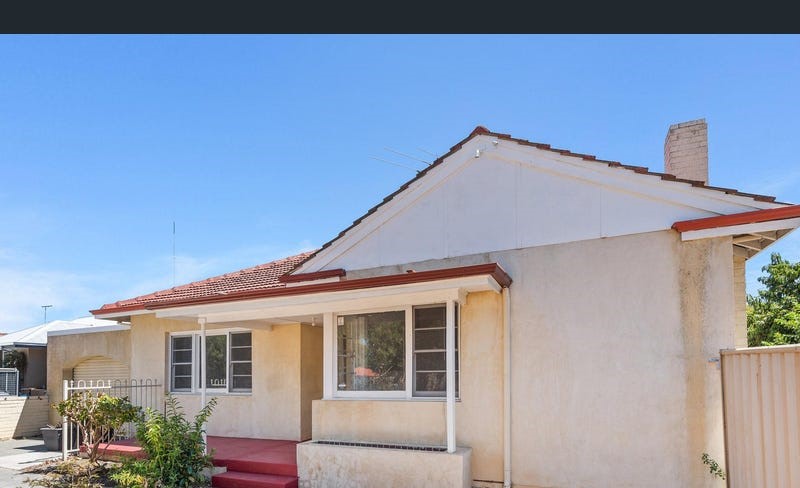 0
0

 0
0
 0
0
