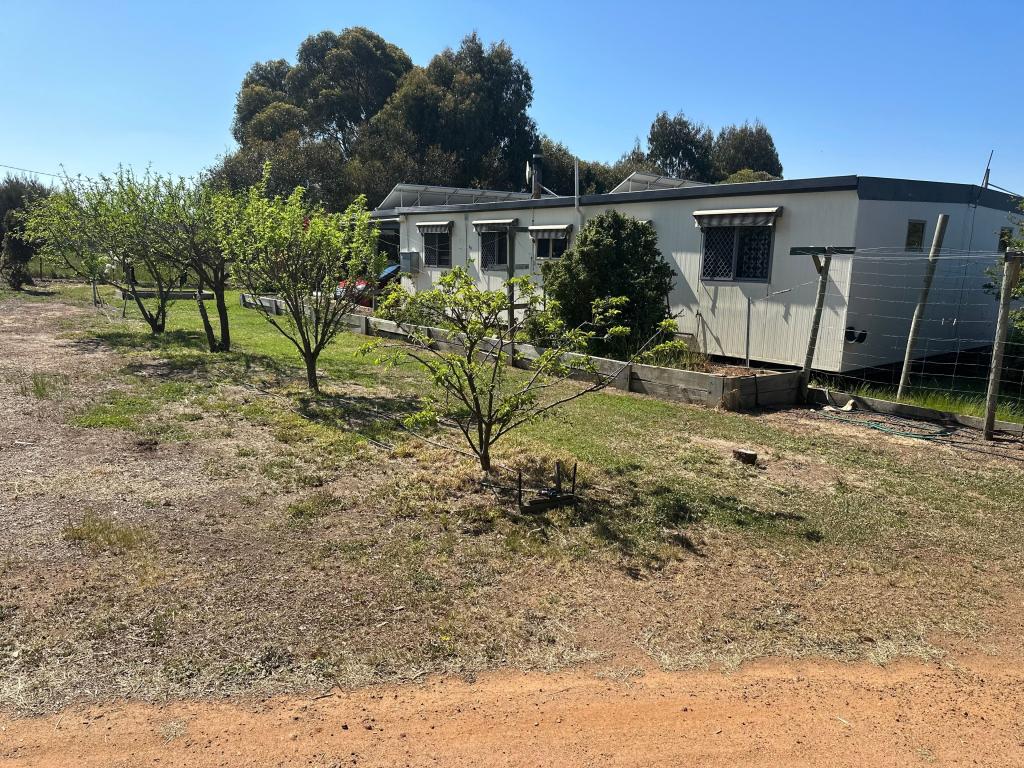
315 Moorilup RoadKendenup WA 6323
Property Details for 315 Moorilup Rd, Kendenup
Last Listing description (March 2016)
Two road frontage, well fenced. Views to the Stirling Ranges and towards the Porongurups. Good Rye grass pasture with a bit of native bush, dam and bitumen frontage. On the Mount Barker and Kendenup schools bus route. This is a lovely rural 8.9.Ha (22 acres) block only 10 minutes from Mount Barker.
Phone Hannah 0448550105
Property History for 315 Moorilup Rd, Kendenup, WA 6323
- 13 Jan 2016Listed for Sale $130000
- 10 Apr 2011Listed for Sale 129000
Commute Calculator
About Kendenup 6323
The size of Kendenup is approximately 395.8 square kilometres. It has 3 parks covering nearly 0.1% of total area. The population of Kendenup in 2011 was 985 people. By 2016 the population was 980 showing a population decline of 0.5% in the area during that time. The predominant age group in Kendenup is 60-69 years. Households in Kendenup are primarily childless couples and are likely to be repaying $1400 - $1799 per month on mortgage repayments. In general, people in Kendenup work in a managers occupation. In 2011, 82% of the homes in Kendenup were owner-occupied compared with 81.3% in 2016.
Kendenup has 1,197 properties. Over the last 5 years, Houses in Kendenup have seen a 197.60% increase in median value, while Units have seen a -48.48% decrease. As at 31 October 2024:
- The median value for Houses in Kendenup is $529,422 while the median value for Units is $301,202.
- Houses have a median rent of $245.
Suburb Insights for Kendenup 6323
Market Insights
Kendenup Trends for Houses
N/A
N/A
View TrendN/A
N/A
Kendenup Trends for Units
N/A
N/A
View TrendN/A
N/A
Neighbourhood Insights
© Copyright 2024 RP Data Pty Ltd trading as CoreLogic Asia Pacific (CoreLogic). All rights reserved.

 0
0

