6 Malop LinkHarrisdale WA 6112
Property Details for 6 Malop Link, Harrisdale
6 Malop Link, Harrisdale is a 4 bedroom, 2 bathroom House with 2 parking spaces and was built in 2010. The property has a land size of 360m2 and floor size of 174m2. While the property is not currently for sale or for rent, it was last sold in December 2009.
Last Listing description (July 2021)
This stunning family home located on a quiet street backing onto Heron Park is an absolute 'MUST VIEW"
- 4 bedrooms
- 2 minor bedrooms with built in robes
- Separate study
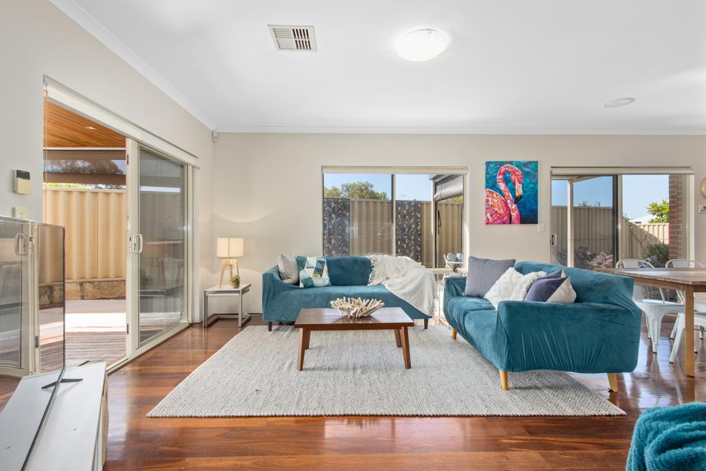
- Open plan living/dining/kitchen with wooden floorboards
- Separate lounge room
- Security alarm system
- Ducted air conditioning
- Beautiful features
- Courtyard backyard
- Entry gate to Heron Park
- Walking distance to Harrisdale Primary & High School
- Close to Stockland Harrisdale Shopping Centre
- Very well presented
TO BOOK A VIEWING PLEASE PHONE 9456 1000. PLEASE NOTE YOU MUST REGISTER IN ORDER TO ATTEND AND FOR YOUR APPLICATION TO BE PROCESSED WITHIN 24 HOURS
DON'T MISS OUT. BRING ALONG ALL COPIES OF PHOTO ID, PAYSLIP (ONE PERIOD) AND BANK STATEMENT.
APPLICATION TURN AROUND TIME NEXT BUSINESS DAY OR SOONER
Property History for 6 Malop Link, Harrisdale, WA 6112
- 13 Jul 2021Listed for Rent $470 / week
- 16 May 2018Listed for Rent - Price not available
- 10 Nov 2017Listed for Rent - Price not available
Commute Calculator
Recent sales nearby
See more recent sales nearbySimilar properties For Sale nearby
See more properties for sale nearbySimilar properties For Rent nearby
See more properties for rent nearbyAbout Harrisdale 6112
The size of Harrisdale is approximately 5.8 square kilometres. It has 19 parks covering nearly 26.3% of total area. The population of Harrisdale in 2011 was 3,806 people. By 2016 the population was 9,077 showing a population growth of 138.5% in the area during that time. The predominant age group in Harrisdale is 30-39 years. Households in Harrisdale are primarily couples with children and are likely to be repaying $1800 - $2399 per month on mortgage repayments. In general, people in Harrisdale work in a professional occupation. In 2011, 84.9% of the homes in Harrisdale were owner-occupied compared with 79.2% in 2016.
Harrisdale has 4,899 properties. Over the last 5 years, Houses in Harrisdale have seen a 96.80% increase in median value, while Units have seen a 68.22% increase. As at 31 October 2024:
- The median value for Houses in Harrisdale is $903,012 while the median value for Units is $618,342.
- Houses have a median rent of $735.
Suburb Insights for Harrisdale 6112
Market Insights
Harrisdale Trends for Houses
N/A
N/A
View TrendN/A
N/A
Harrisdale Trends for Units
N/A
N/A
View TrendN/A
N/A
Neighbourhood Insights
© Copyright 2024 RP Data Pty Ltd trading as CoreLogic Asia Pacific (CoreLogic). All rights reserved.


 0
0
 0
0
 0
0
 0
0

 0
0 0
0
 0
0
 0
0

 0
0
