11/14 Louis StreetBroome WA 6725
Property Details for 11/14 Louis St, Broome
11/14 Louis St, Broome is a 3 bedroom, 2 bathroom Unit and was built in 1982. The property has a land size of 310m2 and floor size of 97m2. While the property is not currently for sale or for rent, it was last sold in December 2024. There are 5 other 3 bedroom Units sold in Broome in the last 12 months.
Last Listing description (January 2025)
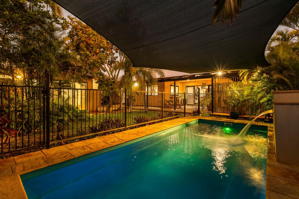
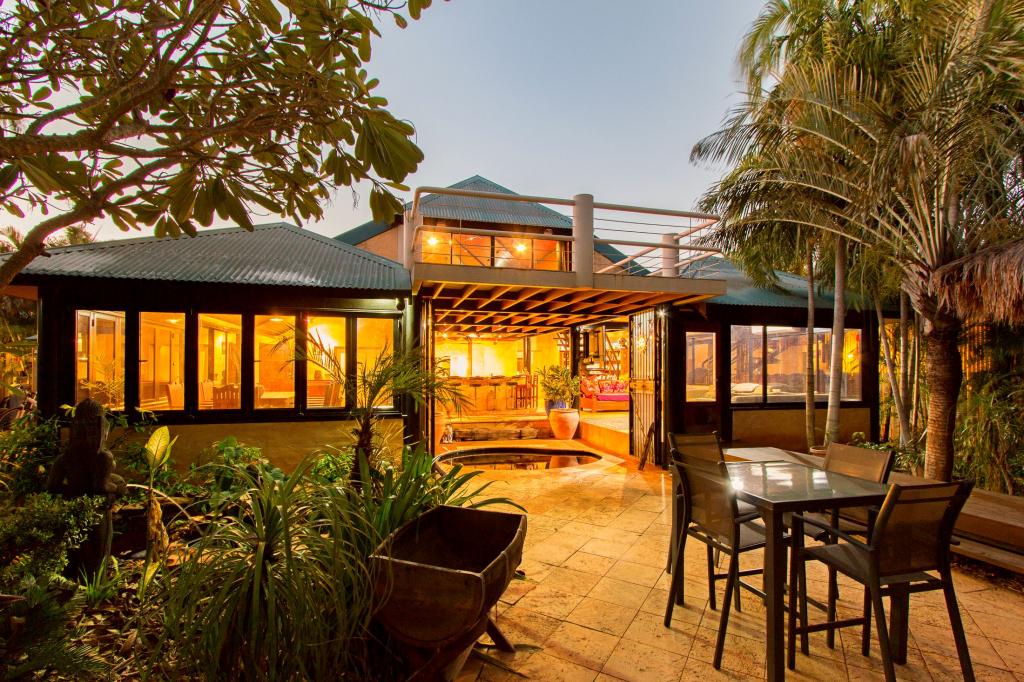
Nestled in a quiet, sought-after street just moments from the heart of town and the pristine Town Beach, this freestanding property offers the perfect blend of modern living and convenience. Boasting a spacious extra-large courtyard and low-maintenance rear yard, it's ideal for those who appreciate outdoor space without the upkeep.Step inside to discover a home with sleek, modern finishes throughout. The kitchen is a standout, featuring stunning stone benchtops and ample storage, while the bathrooms and laundry offer a contemporary design for effortless living. With 2 dedicated car parks and additional space for a trailer or boat, you'll enjoy the luxury of 4 parking spaces in total - a rare find in such a central location.With everything you need at your doorstep, yet situated in a tranquil, quiet setting, this property is a true gem. Whether you're relaxing in the yard, heading to the beach, or enjoying all that the local area has to offer, 11/14 Louis Street is the perfect place to call home.Don't miss out on this incredible opportunity to secure a modern, spacious home in an unbeatable location. Contact us today to arrange your inspection!
Property History for 11/14 Louis St, Broome, WA 6725
- 20 Dec 2024Sold for $570,000
- 12 Dec 2024Listed for Rent $850 / week
- 15 Apr 2012Sold for $375,000
Recent sales nearby
See more recent sales nearbySimilar properties For Sale nearby
See more properties for sale nearby


Similar properties For Rent nearby
See more properties for rent nearby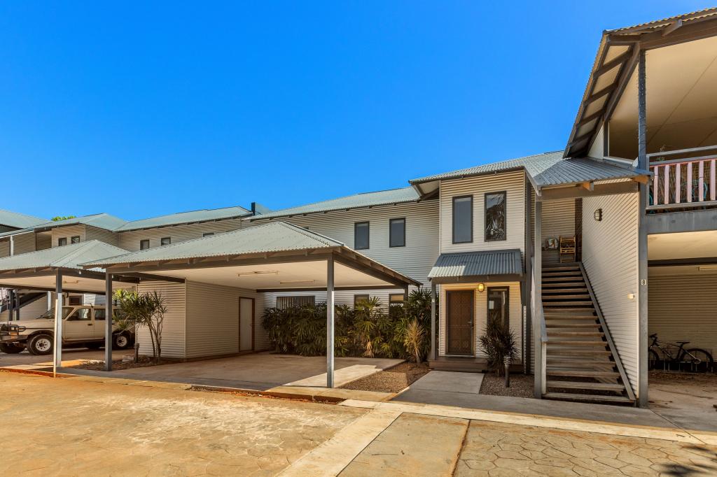
About Broome 6725
The size of Broome is approximately 5.8 square kilometres. It has 9 parks covering nearly 3.5% of total area. The population of Broome in 2011 was 4,290 people. By 2016 the population was 4,042 showing a population decline of 5.8% in the area during that time. The predominant age group in Broome is 30-39 years. Households in Broome are primarily childless couples and are likely to be repaying $1800 - $2399 per month on mortgage repayments. In general, people in Broome work in a professional occupation. In 2011, 33.7% of the homes in Broome were owner-occupied compared with 35.3% in 2016.
Broome has 2,229 properties. Over the last 5 years, Houses in Broome have seen a 40.08% increase in median value, while Units have seen a 74.53% increase. As at 28 February 2025:
- The median value for Houses in Broome is $559,616 while the median value for Units is $391,952.
- Houses have a median rent of $850 while Units have a median rent of $800.
What's around 11/14 Louis St, Broome


Suburb Insights for Broome 6725
Market Insights
Broome Trends for Houses
$560k
11.21%
View Trend$850/W
8.43%
Broome Trends for Units
$392k
14.86%
View Trend$800/W
9.81%
Neighbourhood Insights
Age
Population 4,042
0-9
14%
10-19
12%
20-29
13%
30-39
17%
40-49
14%
50-59
15%
60-69
11%
70-79
3%
80-89
1%
Household Structure
Occupancy
© Copyright 2025 RP Data Pty Ltd trading as CoreLogic Asia Pacific (CoreLogic). All rights reserved.
This product uses cookies and other similar technologies to improve and customise your browsing experience, to tailor content and adverts, and for analytics and metrics regarding visitor usage on this product and other media. We may share cookie and analytics information with third parties for the purposes of advertising. By continuing to use our website, you consent to cookies being used. View our Privacy Policy here.
X