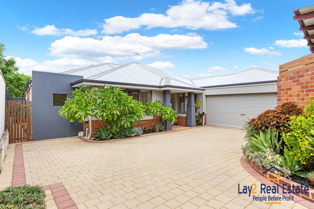
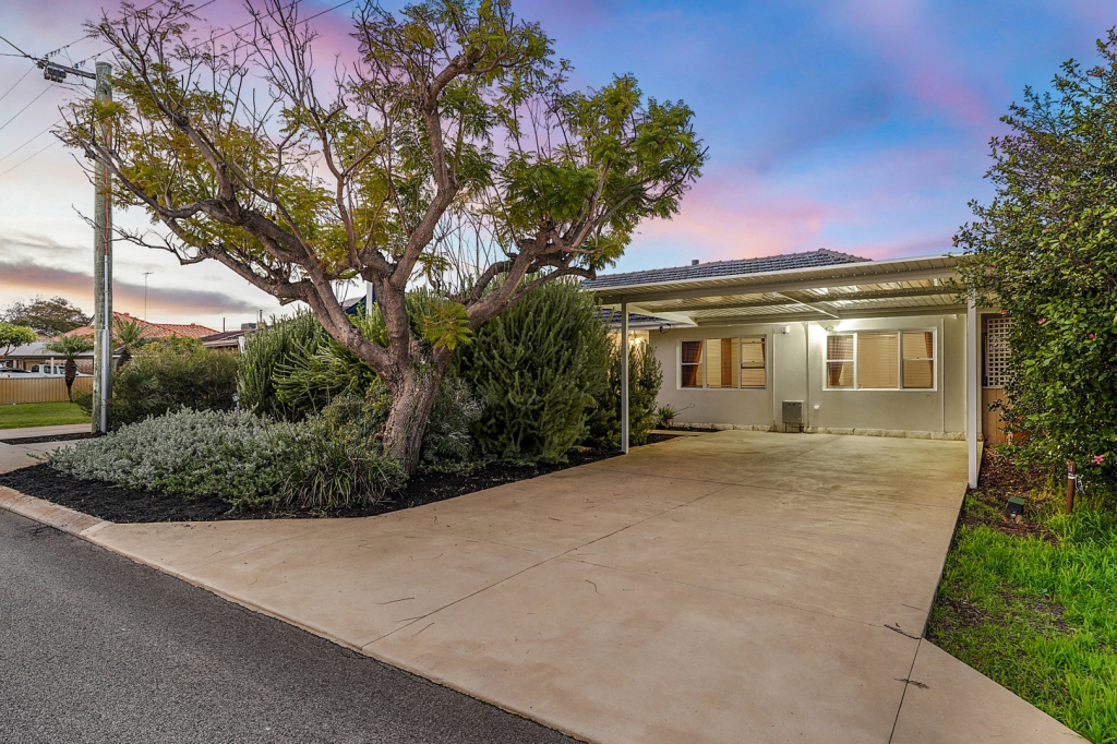
63A Birkett StreetBedford WA 6052

Thinking about insurance?
Get estimated rebuild costs for this property with Sum SureProperty Details for 63a Birkett St, Bedford
63a Birkett St, Bedford is a 3 bedroom, 2 bathroom House with 3 parking spaces and was built in 1994. The property has a land size of 609m2 and floor size of 167m2. While the property is not currently for sale or for rent, it was last sold in January 2019.
Last Listing description (March 2019)
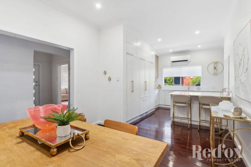
Located in a whisper quiet Cul de sac and close to shops, parks and transport, this very spacious and much loved home is perfect for the family and those that love to entertain. Positioned on a large 607 sqm rear block, this exceptional 3 bed, 2 bath home will undoubtedly impress.
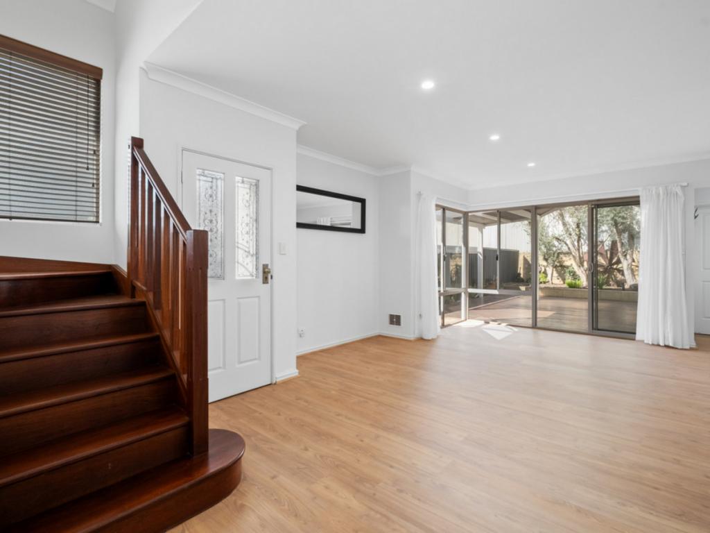
Boasting a functional design and very livable spaces, this home includes a large family/living area, chef's kitchen with walk in pantry, evaporative and split system air conditioning, beautiful outdoor dining with built in bench seats and many more extras.
Conveniently located within walking distance to Bedford IGA (350m), Our Table Restaurant (400m), Promenade Fish and Chips(405m), Newsagency (402m), Grand Prom reserve and Bedford Bowling club (270m) and St Peters Primary School a short 30 second drive.
Solar panels
Veggie patch
Close to schools
Bore and reticulation
Walk in pantry
Studio (man cave)
Renovated Ensuite
Evaporative and split system air conditioning
Ceiling fans
Walk in robe
Large master bedroom
Large second bedroom
Generous amount of storage throughout
Low maintenance gardens
Gas hot water system
Large Chef's kitchen
Very secure property - lock and leave
NBN connected
High ceilings
Large open plan living/dining area
3 car bay garage
Close to public transport (buses)
Two sheds
Don't wait, this Bedford beauty won't last!
Property History for 63a Birkett St, Bedford, WA 6052
- 15 Jan 2019Sold for $625,000
- 09 Jan 2019Listed for Sale UNDER OFFER!
- 06 Jan 2008Sold for $570,000
Recent sales nearby
See more recent sales nearby
Similar properties For Sale nearby
See more properties for sale nearby
Similar properties For Rent nearby
See more properties for rent nearby
About Bedford 6052
The size of Bedford is approximately 2.3 square kilometres. It has 14 parks covering nearly 8.7% of total area. The population of Bedford in 2011 was 4,944 people. By 2016 the population was 5,439 showing a population growth of 10.0% in the area during that time. The predominant age group in Bedford is 30-39 years. Households in Bedford are primarily couples with children and are likely to be repaying $3000 - $3999 per month on mortgage repayments. In general, people in Bedford work in a professional occupation. In 2011, 67.7% of the homes in Bedford were owner-occupied compared with 67.2% in 2016.
Bedford has 2,915 properties. Over the last 5 years, Houses in Bedford have seen a 80.14% increase in median value, while Units have seen a 116.20% increase. As at 28 February 2025:
- The median value for Houses in Bedford is $1,028,462 while the median value for Units is $731,672.
- Houses have a median rent of $693 while Units have a median rent of $650.
What's around 63a Birkett St, Bedford
63a Birkett St, Bedford is in the school catchment zone for John Forrest Secondary College.


Suburb Insights for Bedford 6052
Market Insights
Bedford Trends for Houses
$1.03M
16.52%
View Trend$692.5/W
3.79%
Bedford Trends for Units
$732k
28.74%
View Trend$650/W
4.89%
Neighbourhood Insights
Age
Population 5,439
0-9
14%
10-19
11%
20-29
13%
30-39
16%
40-49
15%
50-59
13%
60-69
9%
70-79
6%
80-89
3%
Household Structure
Occupancy
© Copyright 2025 RP Data Pty Ltd trading as CoreLogic Asia Pacific (CoreLogic). All rights reserved.
This product uses cookies and other similar technologies to improve and customise your browsing experience, to tailor content and adverts, and for analytics and metrics regarding visitor usage on this product and other media. We may share cookie and analytics information with third parties for the purposes of advertising. By continuing to use our website, you consent to cookies being used. View our Privacy Policy here.
X