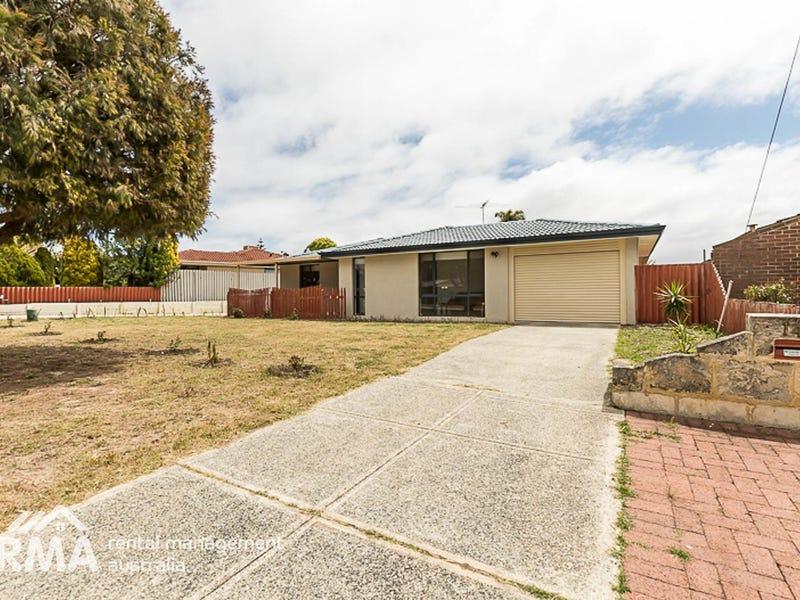
29 Barlow WayBalga WA 6061

Thinking about insurance?
Get estimated rebuild costs for this property with Sum SureProperty Details for 29 Barlow Way, Balga
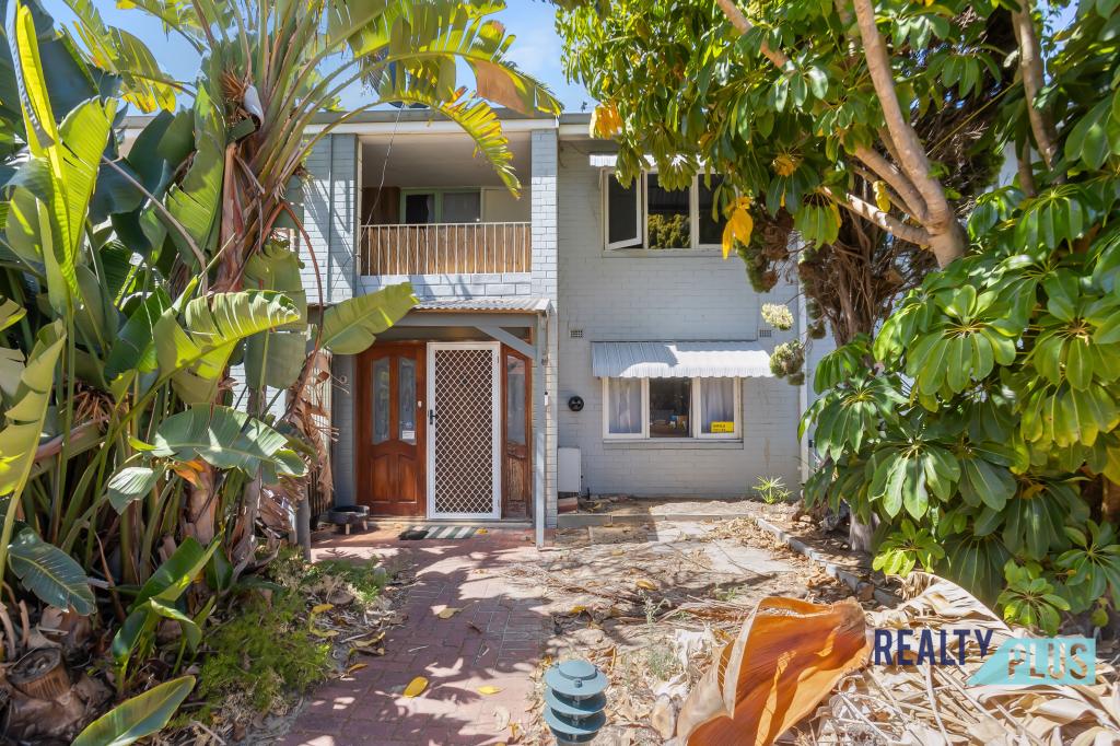
29 Barlow Way, Balga is a 4 bedroom, 1 bathroom House with 1 parking spaces and was built in 1981. The property has a land size of 680m2 and floor size of 155m2. While the property is not currently for sale or for rent, it was last sold in November 2022.
Last Listing description (December 2022)
This charming 4 bedroom, 1 bathroom home is a fantastic opportunity for you to move into a well-presented property on a generous 680m2! Featuring multiple living spaces, this home flows from the front lounge with bar nook, through to the dining, kitchen and living area. The bedrooms have built-in robes for storage and the bathroom features a round bath and separate shower. Step outside and you'll see the undercover paved patio for entertaining, that has good supervision of the neat lawn space plus a garden shed around the side for storage. Conveniently located near local schools, shops and only 25 minutes away from Perth City or the beach, this is a home you don't want to miss out on!Contact John Tran for your viewing!4 bedrooms 1 bathroom with feature round bathBuilt-in robes to bedroomsKitchen with gas cooktop & built-in pantryFront lounge Bar nookDiningLiving LaundryPatioCourtyardGarden shedLawn areaEstablished front garden bedsLand area: 680m2Disclaimer:This information is provided for general information purposes only and is based on information provided by the Seller and may be subject to change. No warranty or representation is made as to its accuracy and interested parties should place no reliance on it and should make their own independent inquiries.
Property History for 29 Barlow Way, Balga, WA 6061
- 10 Nov 2022Sold for $495,000
- 07 Nov 2022Listed for Sale UNDER OFFER BY JOHN TRAN
- 21 Oct 1995Sold for $101,750
Recent sales nearby
See more recent sales nearbySimilar properties For Sale nearby
See more properties for sale nearby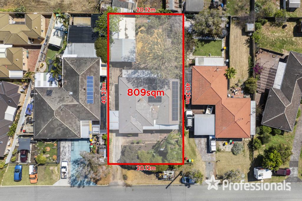

Similar properties For Rent nearby
See more properties for rent nearby
About Balga 6061
The size of Balga is approximately 5.2 square kilometres. It has 38 parks covering nearly 14.5% of total area. The population of Balga in 2011 was 10,701 people. By 2016 the population was 12,698 showing a population growth of 18.7% in the area during that time. The predominant age group in Balga is 20-29 years. Households in Balga are primarily couples with children and are likely to be repaying $1800 - $2399 per month on mortgage repayments. In general, people in Balga work in a trades occupation. In 2011, 49.5% of the homes in Balga were owner-occupied compared with 50.6% in 2016.
Balga has 7,709 properties. Over the last 5 years, Houses in Balga have seen a 110.46% increase in median value, while Units have seen a 147.33% increase. As at 31 March 2025:
- The median value for Houses in Balga is $609,453 while the median value for Units is $614,235.
- Houses have a median rent of $600 while Units have a median rent of $620.
What's around 29 Barlow Way, Balga
29 Barlow Way, Balga is in the school catchment zone for Balga Senior High School.


Suburb Insights for Balga 6061
Market Insights
Balga Trends for Houses
$609k
21.18%
View Trend$600/W
5.67%
Balga Trends for Units
$614k
28.38%
View Trend$620/W
5.96%
Neighbourhood Insights
Age
Population 12,698
0-9
15%
10-19
10%
20-29
21%
30-39
19%
40-49
11%
50-59
9%
60-69
8%
70-79
5%
80-89
2%
Household Structure
Occupancy
© Copyright 2025 RP Data Pty Ltd trading as CoreLogic Asia Pacific (CoreLogic). All rights reserved.
This product uses cookies and other similar technologies to improve and customise your browsing experience, to tailor content and adverts, and for analytics and metrics regarding visitor usage on this product and other media. We may share cookie and analytics information with third parties for the purposes of advertising. By continuing to use our website, you consent to cookies being used. View our Privacy Policy here.
X