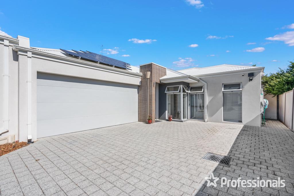
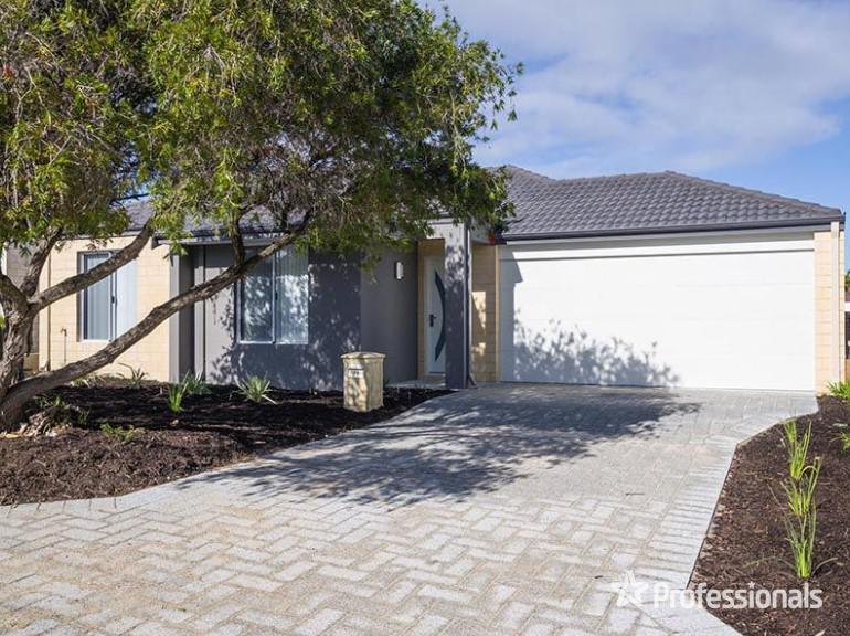
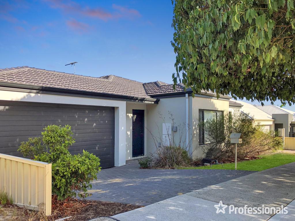
27A Burford StreetBalga WA 6061

Property Details for 27a Burford St, Balga
27a Burford St, Balga is a 3 bedroom, 2 bathroom Townhouse with 2 parking spaces and was built in 2008. The property has a land size of 287m2 and floor size of 160m2. While the property is not currently for sale or for rent, it was last sold in February 2022.
Last Listing description (March 2022)
Cleverly designed Street frontage home makes use of the orientation and space, nothing is wasted and the room sizes are generous at 195sqm over two levels. Occupying 287sqm of the strata plan and completed in 2008 this is a well-designed Residence feels spacious and airy giving you and the family ample room to move and live your lives made that extra bit more comfortable with Air-conditioning and there are no strata fees.
The double garage is oversized and high allowing the biggest of 4wd room to park securely behind the remote controlled roller-door there is an access door into the property leading to an enormous living area on one side a fully equipped Chef's kitchen
Upstairs is where the bedrooms are, a huge master bedroom with a large walk in robe and generous ensuite. The landing is a versatile room capable to be used as a study, toy room or teenagers retreat off this are two more generous bedrooms both with big windows and built in robes all serviced by a main bathroom.
If storage is normally an issue it won't be here with under stairs and three big linen presses plus room to burn in the garage and still fit two cars you are set.
Great location close to a variety of medical professionals, transport, parklands and just a short walk to Shopping Centre or catch the bus.
Property History for 27a Burford St, Balga, WA 6061
- 28 Feb 2022Sold for $440,000
- 24 Feb 2022Listed for Sale From $420,000
- 16 Apr 2016Sold for $430,000
Recent sales nearby
See more recent sales nearbySimilar properties For Sale nearby
See more properties for sale nearby

Similar properties For Rent nearby
See more properties for rent nearby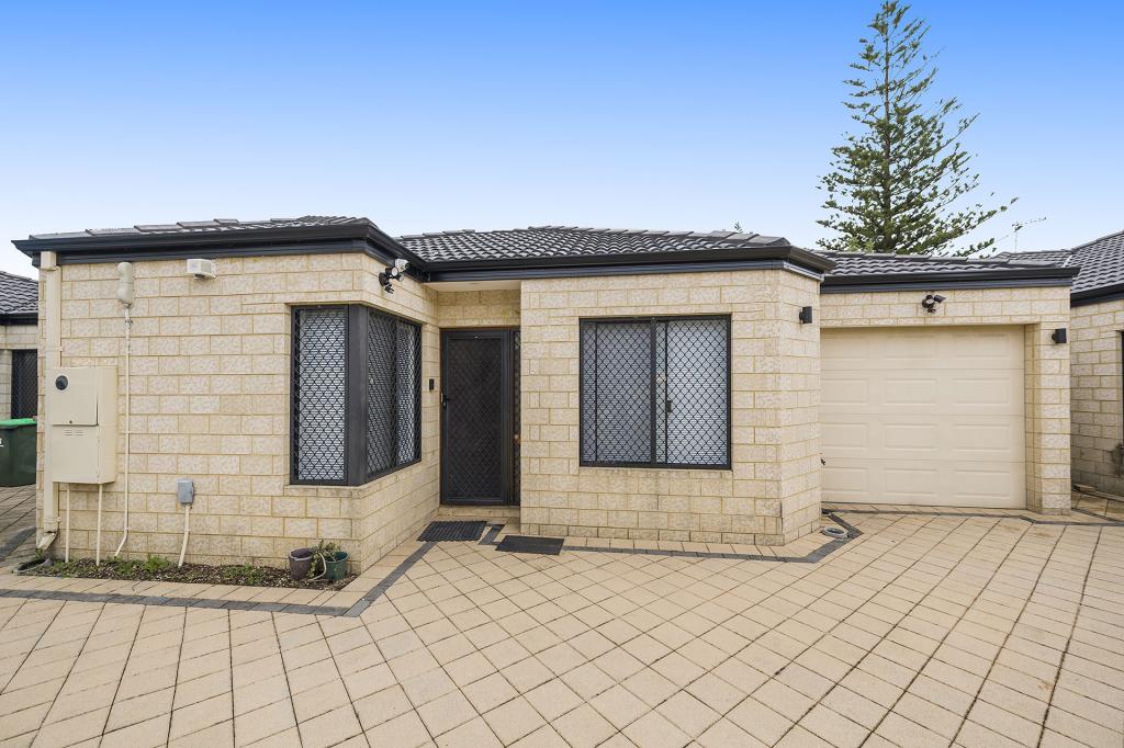

About Balga 6061
The size of Balga is approximately 5.2 square kilometres. It has 38 parks covering nearly 14.5% of total area. The population of Balga in 2011 was 10,701 people. By 2016 the population was 12,698 showing a population growth of 18.7% in the area during that time. The predominant age group in Balga is 20-29 years. Households in Balga are primarily couples with children and are likely to be repaying $1800 - $2399 per month on mortgage repayments. In general, people in Balga work in a trades occupation. In 2011, 49.5% of the homes in Balga were owner-occupied compared with 50.6% in 2016.
Balga has 7,698 properties. Over the last 5 years, Houses in Balga have seen a 111.61% increase in median value, while Units have seen a 135.98% increase. As at 28 February 2025:
- The median value for Houses in Balga is $612,087 while the median value for Units is $581,238.
- Houses have a median rent of $600 while Units have a median rent of $620.
What's around 27a Burford St, Balga
27a Burford St, Balga is in the school catchment zone for North Balga Primary School and Balga Senior High School.


Suburb Insights for Balga 6061
Market Insights
Balga Trends for Houses
$612k
26.48%
View Trend$600/W
5.62%
Balga Trends for Units
$581k
25.84%
View Trend$620/W
6.03%
Neighbourhood Insights
Age
Population 12,698
0-9
15%
10-19
10%
20-29
21%
30-39
19%
40-49
11%
50-59
9%
60-69
8%
70-79
5%
80-89
2%
Household Structure
Occupancy
© Copyright 2025 RP Data Pty Ltd trading as CoreLogic Asia Pacific (CoreLogic). All rights reserved.
This product uses cookies and other similar technologies to improve and customise your browsing experience, to tailor content and adverts, and for analytics and metrics regarding visitor usage on this product and other media. We may share cookie and analytics information with third parties for the purposes of advertising. By continuing to use our website, you consent to cookies being used. View our Privacy Policy here.
X