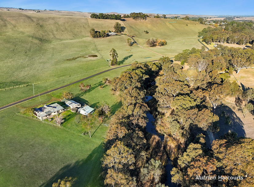
140 Corndale RoadCasterton VIC 3311
Property Details for 140 Corndale Rd, Casterton
Last Listing description (July 2015)
This 142 Ha property (351 acre approx.) is located off the Corndale road overlooking the Glenelg river and is just 4.5 kilometers from the scenic township of Casterton. The property consists of 3 titles of which 58 hectares (145 acres) approx. is planted to Eucalypt Globulus ( Blue-gums ) which were planted in 2006, the balance of the country is suited to grazing. There is a partially renovated cottage that has sweeping views overlooking the Glenelg River and the township of Casterton, there is also a one stand shearing shed as well as a smaller storage shed. The property has Deep Creek running through the northern part of the property and is bounded on both sides by native fauna and flora. The property is watered by Deep creek and dams scattered through out the property.
Property History for 140 Corndale Rd, Casterton, VIC 3311
- 18 Aug 2021Sold for $1,400,000
- 15 Nov 2015Sold for $420,000
- 07 Aug 2014Listed for Sale $450,000
Commute Calculator
Recent sales nearby
See more recent sales nearbyAbout Casterton 3311
The size of Casterton is approximately 226.9 square kilometres. It has 9 parks covering nearly 2.6% of total area. The population of Casterton in 2011 was 1,763 people. By 2016 the population was 1,684 showing a population decline of 4.5% in the area during that time. The predominant age group in Casterton is 60-69 years. Households in Casterton are primarily childless couples and are likely to be repaying $1000 - $1399 per month on mortgage repayments. In general, people in Casterton work in a labourer occupation. In 2011, 78.4% of the homes in Casterton were owner-occupied compared with 77% in 2016.
Casterton has 1,245 properties. Over the last 5 years, Houses in Casterton have seen a 72.32% increase in median value, while Units have seen a 3.32% increase. As at 31 October 2024:
- The median value for Houses in Casterton is $259,706 while the median value for Units is $268,157.
Suburb Insights for Casterton 3311
Market Insights
Casterton Trends for Houses
N/A
N/A
View TrendN/A
N/A
Casterton Trends for Units
N/A
N/A
View TrendN/A
N/A
Neighbourhood Insights
© Copyright 2024 RP Data Pty Ltd trading as CoreLogic Asia Pacific (CoreLogic). All rights reserved.

 0
0/assets/perm/tunu7if6a4i6neml4njsidquia?signature=a6029fbc8f08fa0f2e05ec46363bd0664ef0ed632312049a44909ce0f089c385) 0
0/assets/perm/eos7hvp47mi6tm6e76yqbnytke?signature=3d5674b306846bd1770f820923c593d5beb44616bbb3af866d1cbd4e53690415) 0
0
