193 Arbour BoulevardBurnside Heights VIC 3023
Property Details for 193 Arbour Bvd, Burnside Heights
193 Arbour Bvd, Burnside Heights is a 4 bedroom, 2 bathroom House with 2 parking spaces and was built in 2008. The property has a land size of 641m2 and floor size of 175m2. While the property is not currently for sale or for rent, it was last sold in February 2020.
Last Listing description (February 2020)
Whether youre an investor or looking for a place to call home, this will be perfect. An elegant home on 641m2 (approx.) located in a quiet pocket of Burnside Heights opposite The Burnside Heights Recreation Reserve & only minutes away from Kororoit Creek Primary School, recently expanded CS Square, restaurants & public transport.
The hub of the home showcases an open plan living & dining area, ultra-modern kitchen with stainless steel appliances, dishwasher, a walk in pantry and an alfresco overlooking the back yard. The home offers 2 living areas and including a formal lounge making it perfect for entertaining guests or a separate space for the kids, 4-bedrooms including a master with a full ensuite & WIR.
Extras include a remote access double car garage, ducted heating & split air-conditioning security alarm, spacious laundry with storage and a low maintenance front & rear yard great for the kids and pets to play.
Property History for 193 Arbour Bvd, Burnside Heights, VIC 3023
- 15 Feb 2020Sold for $685,000
- 30 Jan 2020Listed for Sale $640,000 - $690,000
- 27 Nov 2007Sold for $151,000
Commute Calculator
Recent sales nearby
See more recent sales nearby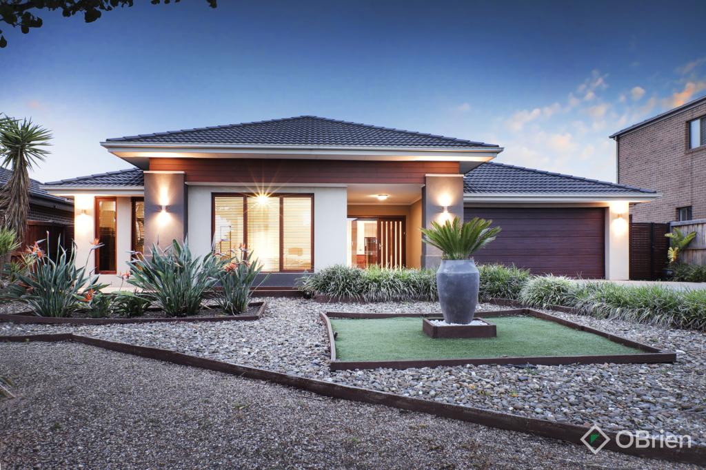 0
0Similar properties For Sale nearby
See more properties for sale nearby 0
0
 0
0 0
0Similar properties For Rent nearby
See more properties for rent nearby 0
0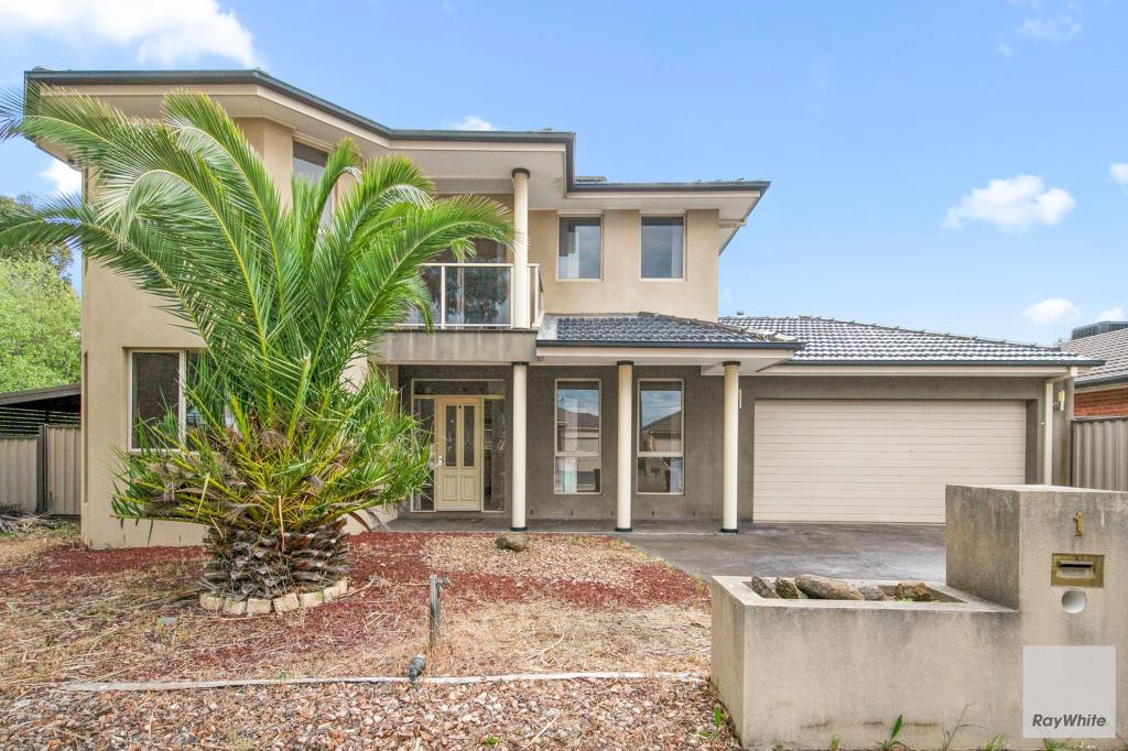 0
0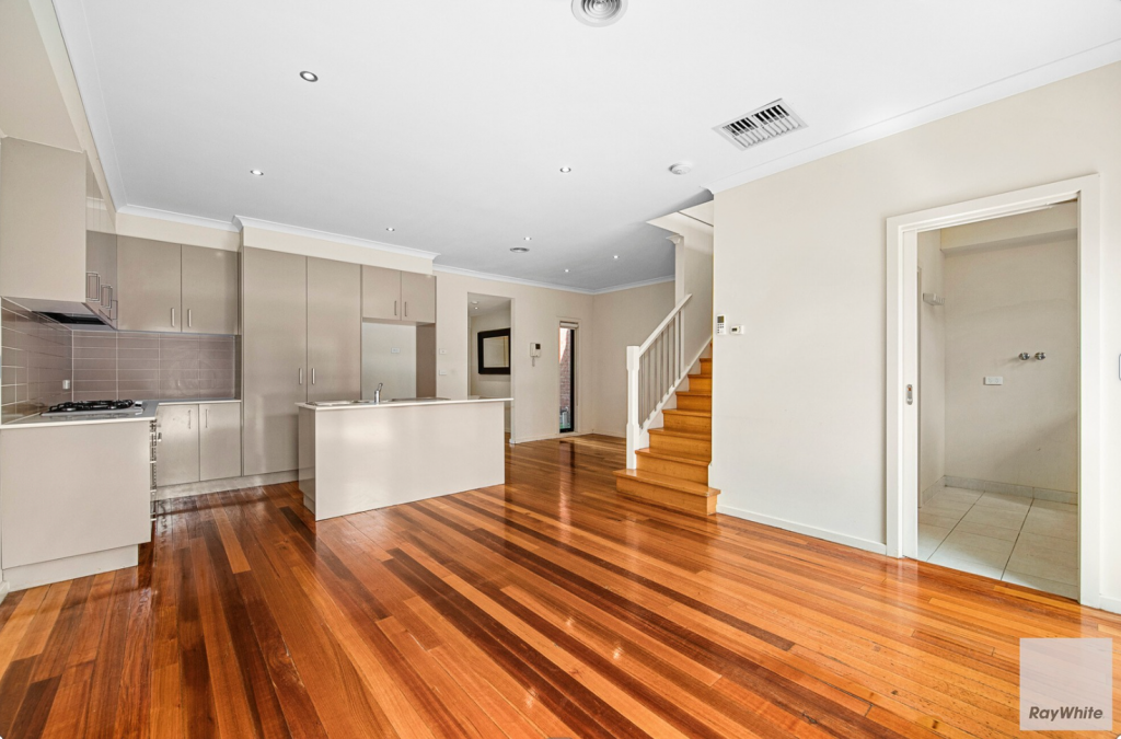 0
0About Burnside Heights 3023
The size of Burnside Heights is approximately 2 square kilometres. It has 9 parks covering nearly 27.1% of total area. The population of Burnside Heights in 2011 was 5,000 people. By 2016 the population was 6,060 showing a population growth of 21.2% in the area during that time. The predominant age group in Burnside Heights is 0-9 years. Households in Burnside Heights are primarily couples with children and are likely to be repaying $1800 - $2399 per month on mortgage repayments. In general, people in Burnside Heights work in a professional occupation. In 2011, 78.6% of the homes in Burnside Heights were owner-occupied compared with 78.1% in 2016.
Burnside Heights has 1,877 properties. Over the last 5 years, Houses in Burnside Heights have seen a 26.26% increase in median value, while Units have seen a 9.58% increase. As at 31 October 2024:
- The median value for Houses in Burnside Heights is $778,764 while the median value for Units is $558,703.
- Houses have a median rent of $550 while Units have a median rent of $500.
Suburb Insights for Burnside Heights 3023
Market Insights
Burnside Heights Trends for Houses
N/A
N/A
View TrendN/A
N/A
Burnside Heights Trends for Units
N/A
N/A
View TrendN/A
N/A
Neighbourhood Insights
© Copyright 2024 RP Data Pty Ltd trading as CoreLogic Asia Pacific (CoreLogic). All rights reserved.
This product uses cookies and other similar technologies to improve and customise your browsing experience, to tailor content and adverts, and for analytics and metrics regarding visitor usage on this product and other media. We may share cookie and analytics information with third parties for the purposes of advertising. By continuing to use our website, you consent to cookies being used. View our Privacy Policy here.
X