6 Elginshore DrCurrie TAS 7256
Property Details for 6 Elginshore Dr, Currie
Last Listing description (March 2023)
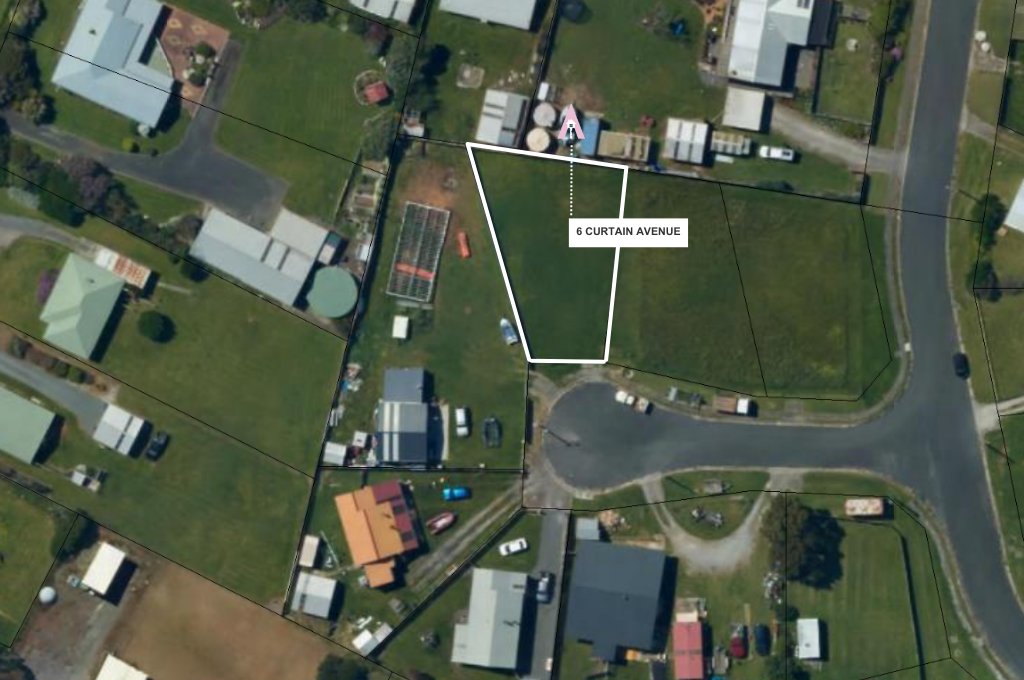
This development is located on Elginshore Drive and is accessed off Charles Street to the north of Currie Harbour. All lots have title access to Elginshore Drive which is sealed and is a local government road. The development comprises 16 lots, 6 of which are sold and 2 are currently under offer.
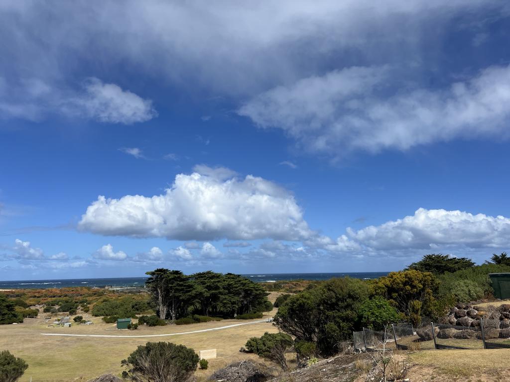
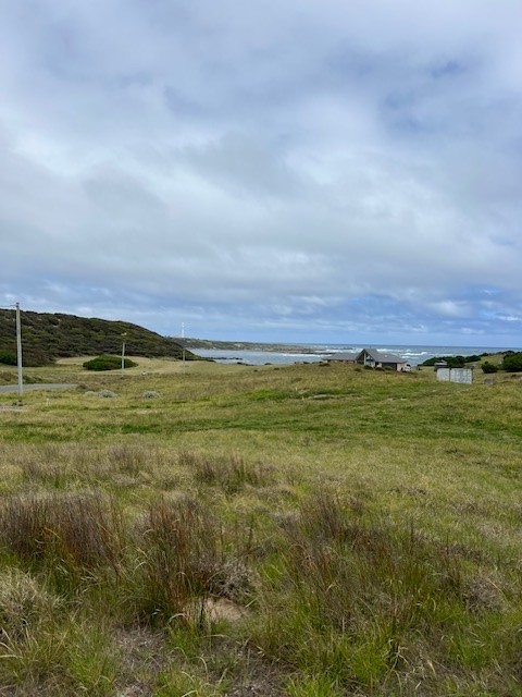
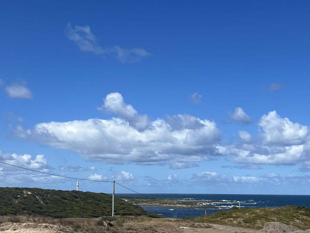
The land is gently rolling as it falls towards Currie Harbour in the south and provides some magnificent views over Currie Harbour including the lighthouse, to the vast expanse of the Southern Ocean to the west and rural views inland.
The blocks are zoned "low density residential", varying in size from 2,808 square metres to 7,906 square metres. This zoning allows for a minimum block size of 2,500 square metres. Mains electricity and telephone service are available from Elginshore Drive
Property History for 6 Elginshore Dr, Currie, TAS 7256
- 05 Apr 2022Sold for $130,000
- 02 Jul 2019Listed for Sale Best offer over $130,000
Commute Calculator
Recent sales nearby
See more recent sales nearbySimilar properties For Sale nearby
See more properties for sale nearbyAbout Currie 7256
The size of Currie is approximately 11.9 square kilometres. It has 2 parks covering nearly 3.5% of total area. The population of Currie in 2011 was 1,091 people. By 2016 the population was 768 showing a population decline of 29.6% in the area during that time. The predominant age group in Currie is 60-69 years. Households in Currie are primarily childless couples and are likely to be repaying $1000 - $1399 per month on mortgage repayments. In general, people in Currie work in a labourer occupation. In 2011, 59.1% of the homes in Currie were owner-occupied compared with 59.2% in 2016.
Currie has 587 properties. Over the last 5 years, Houses in Currie have seen a 22.87% increase in median value, while Units have seen a 85.58% increase. As at 31 October 2024:
- The median value for Houses in Currie is $399,000 while the median value for Units is $306,792.
Suburb Insights for Currie 7256
Market Insights
Currie Trends for Houses
N/A
N/A
View TrendN/A
N/A
Currie Trends for Units
N/A
N/A
View TrendN/A
N/A
Neighbourhood Insights
© Copyright 2024 RP Data Pty Ltd trading as CoreLogic Asia Pacific (CoreLogic). All rights reserved.

 0
0 0
0 0
0 0
0

