29 Gramp AvenueAngaston SA 5353
Property Details for 29 Gramp Ave, Angaston
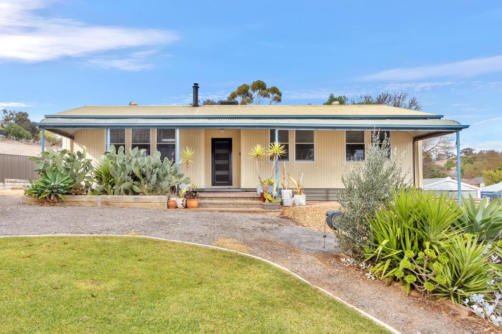
29 Gramp Ave, Angaston is a 3 bedroom, 1 bathroom House with 2 parking spaces and was built in 1950. The property has a land size of 936m2 and floor size of 142m2. While the property is not currently for sale or for rent, it was last sold in November 2021.
Last Listing description (June 2017)
This 1950s home is neat as a pin and has been loved by the same family that had it built in 1950. Situated on a generous allotment of 918.6m with a northerly aspect makes this home ideal for the first home buyer or the person looking for an immaculately looked after home with extensive shedding, rainwater through out the home, chook run, fruit trees and a veggie garden that will feed the whole family.
Property History for 29 Gramp Ave, Angaston, SA 5353
- 29 Nov 2021Sold for $300,000
- 13 Nov 2015Sold for $270,000
- 14 Sep 2015Listed for Sale $275,000
Commute Calculator
Recent sales nearby
See more recent sales nearbySimilar properties For Sale nearby
See more properties for sale nearbyAbout Angaston 5353
The size of Angaston is approximately 78.3 square kilometres. It has 9 parks covering nearly 0.5% of total area. The population of Angaston in 2011 was 1,909 people. By 2016 the population was 2,096 showing a population growth of 9.8% in the area during that time. The predominant age group in Angaston is 50-59 years. Households in Angaston are primarily childless couples and are likely to be repaying $1000 - $1399 per month on mortgage repayments. In general, people in Angaston work in a labourer occupation. In 2011, 69.1% of the homes in Angaston were owner-occupied compared with 69.3% in 2016.
Angaston has 1,467 properties. Over the last 5 years, Houses in Angaston have seen a 91.14% increase in median value, while Units have seen a 104.40% increase. As at 31 October 2024:
- The median value for Houses in Angaston is $635,838 while the median value for Units is $397,366.
- Houses have a median rent of $450.
Suburb Insights for Angaston 5353
Market Insights
Angaston Trends for Houses
N/A
N/A
View TrendN/A
N/A
Angaston Trends for Units
N/A
N/A
View TrendN/A
N/A
Neighbourhood Insights
© Copyright 2024 RP Data Pty Ltd trading as CoreLogic Asia Pacific (CoreLogic). All rights reserved.


/assets/perm/ggtoekxqy4i6var7pmjkzfsbfi?signature=cfde342dabf3f19174167aa750cf89a31514409f03047a46f762cb7454f74bf4) 0
0/assets/perm/6vsbqdtqo4i63agds4ysgruvge?signature=61b69143fa2f3f9b143f7e5ceb570c5a22a385d44d451c3391b9358d557cd46c) 0
0/assets/perm/7ne4mch64yi6tdpebuiawt4esm?signature=0533cabbb1237fcb2f32000a48ad039247a89cafc8c934b3595a6f80e906233a) 0
0 0
0 0
0
 0
0

