333 Bruce HighwayWangaratta QLD 4806
Property Details for 333 Bruce Hwy, Wangaratta
Last Listing description (July 2016)
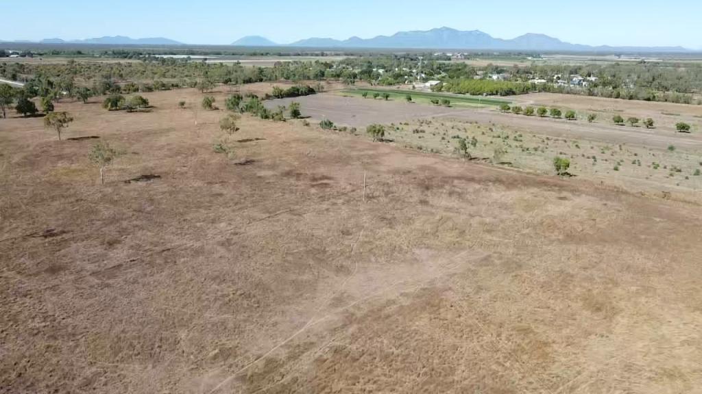
This 642 acre grazing block has creek frontage to Wangaratta Creek in the Burdekin Shire and is about 20km from Home Hill CBD. It is fully fenced and divided into two paddocks,
approximately 250 acres are black soil with the remainder being iron bark ridge country.
The vendor has recently built a large storage dam which has filled in recent rains.There are several other locations on small streams on the property where dams can be easily constructed without any legal requirements.This water could be utilised to irrigate the black soil country.
Here is a chance to secure grazing land where one day the Water for Bowen water channel is designed to go. Call Cass today for more information.
Property History for 333 Bruce Hwy, Wangaratta, QLD 4806
- 05 Aug 2021Sold for $500,000
- 13 Mar 2020Sold for $340,000
- 17 Mar 2016Listed for Sale $350,000 Neg
Commute Calculator
Recent sales nearby
See more recent sales nearbyAbout Wangaratta 4806
The size of Wangaratta is approximately 186.7 square kilometres. The population of Wangaratta in 2011 was 296 people. By 2016 the population was 18 showing a population decline of 93.9% in the area during that time. The predominant age group in Wangaratta is 0-9 years. Households in Wangaratta are primarily childless couples and are likely to be repaying under $300 per month on mortgage repayments. In general, people in Wangaratta work in a managers occupation. In 2011, 75.5% of the homes in Wangaratta were owner-occupied compared with 140% in 2016..
Wangaratta has 18 properties. As at 31 December 2024:
- The median value for Houses in Wangaratta is $377,802.
Suburb Insights for Wangaratta 4806
Market Insights
Wangaratta Trends for Houses
N/A
N/A
View TrendN/A
N/A
Wangaratta Trends for Units
N/A
N/A
View TrendN/A
N/A
Neighbourhood Insights
© Copyright 2025 RP Data Pty Ltd trading as CoreLogic Asia Pacific (CoreLogic). All rights reserved.

/assets/perm/krugsvd5lii6zimaz5eh6wkgky?signature=93847ce65269e0f0e78a46a8a144831f701206fb659f0ad4f37540af1b36dccc) 0
0
 0
0/assets/perm/ld3wc7h7zai6tg22qht2ms4sey?signature=567ccecdd8510067d0340ba83c2f93b548bc276ffc11fe11e52c4829ae08b0e4) 0
0
