39 Hay StreetTewantin QLD 4565

Thinking about insurance?
Get estimated rebuild costs for this property with Sum SureProperty Details for 39 Hay St, Tewantin
39 Hay St, Tewantin is a 3 bedroom, 2 bathroom House with 2 parking spaces. The property has a land size of 506m2. While the property is not currently for sale or for rent, it was last sold in January 2018.
Last Listing description (March 2018)
This gorgeous low set home represents excellence in design while accommodating a superb family lifestyle in the heart of old Tewantin. Within minutes to the Noosa River you will love living here.
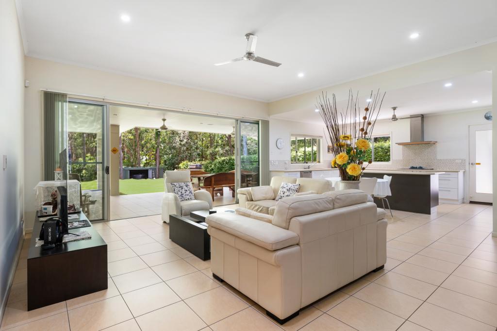
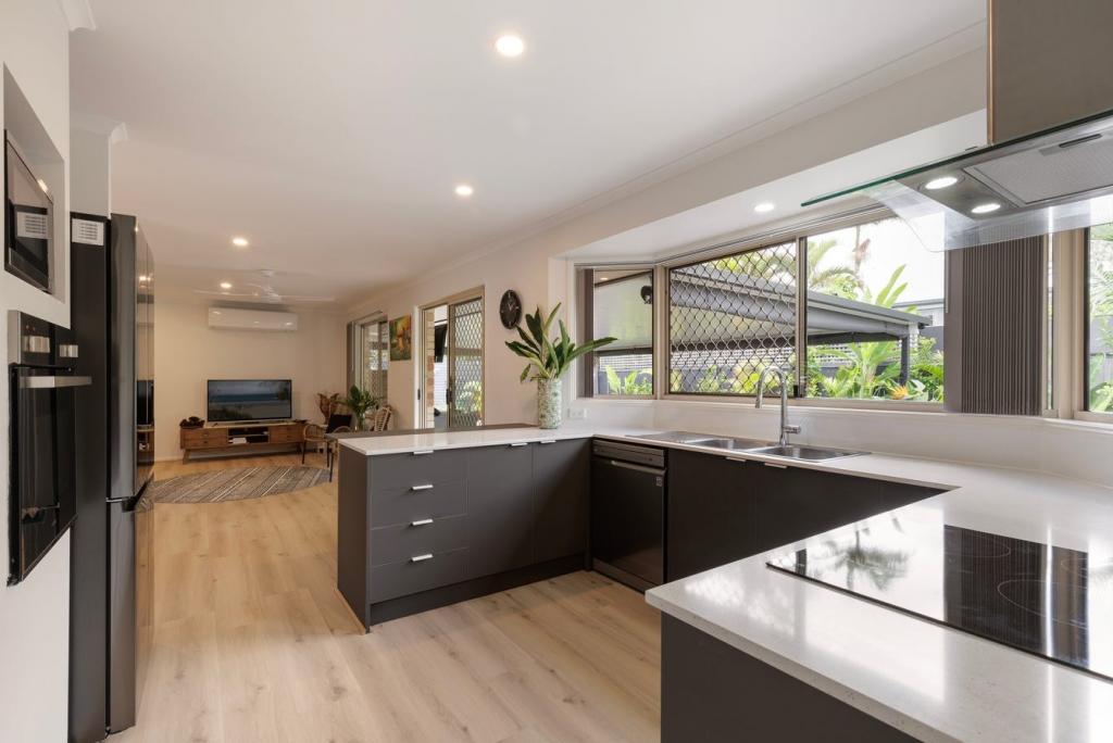
Stylish and functional in design boasting an exquisite contemporary designer kitchen complete with Adriatic lime stone bench tops, stainless Steele appliances and stunning quality cabinetry.
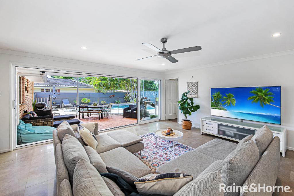
The spacious open floor plan offers seamless integration between indoor and outdoor spaces complete with alfresco entertaining and manicured grounds overlooking the in ground sparkling pool.
3 Spacious bedrooms, main with walk in robe and ensuite with spa bath
Second spacious bathroom
3 toilets
Tiled open plan living, high ceilings and reverse cycle air conditioners
Private undercover outdoor area overlooking the in ground pool
Gourmet kitchen with quality lime stone bench tops
Ducted vacuum
Solar panels
Garden sprinklers
Double lock up garage
Established gardens
Property History for 39 Hay St, Tewantin, QLD 4565
- 27 Jan 2018Sold for $865,000
- 19 Jan 2018Listed for Sale $889,000
- 22 Feb 2005Sold for $830,000
Recent sales nearby
See more recent sales nearby

Similar properties For Sale nearby
See more properties for sale nearby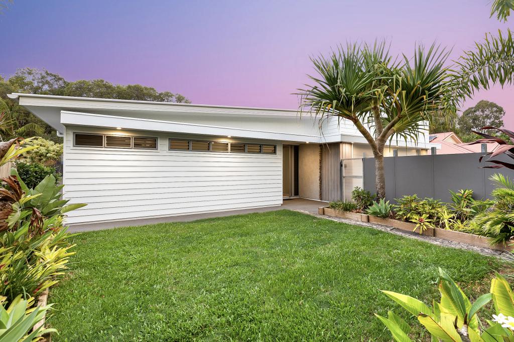

Similar properties For Rent nearby
See more properties for rent nearby
About Tewantin 4565
The size of Tewantin is approximately 26.2 square kilometres. It has 28 parks covering nearly 114.6% of total area. The population of Tewantin in 2011 was 10,659 people. By 2016 the population was 10,913 showing a population growth of 2.4% in the area during that time. The predominant age group in Tewantin is 60-69 years. Households in Tewantin are primarily childless couples and are likely to be repaying $1800 - $2399 per month on mortgage repayments. In general, people in Tewantin work in a trades occupation. In 2011, 64% of the homes in Tewantin were owner-occupied compared with 65.8% in 2016.
Tewantin has 5,489 properties. Over the last 5 years, Houses in Tewantin have seen a 85.17% increase in median value, while Units have seen a 62.81% increase. As at 31 March 2025:
- The median value for Houses in Tewantin is $1,143,425 while the median value for Units is $718,875.
- Houses have a median rent of $810 while Units have a median rent of $570.
What's around 39 Hay St, Tewantin
39 Hay St, Tewantin is in the school catchment zone for Tewantin State School and Sunshine Beach State High School.


Suburb Insights for Tewantin 4565
Market Insights
Tewantin Trends for Houses
N/A
N/A
View TrendN/A
N/A
Tewantin Trends for Units
N/A
N/A
View TrendN/A
N/A
Neighbourhood Insights
Age
Population 10,913
0-9
10%
10-19
11%
20-29
7%
30-39
9%
40-49
13%
50-59
14%
60-69
15%
70-79
12%
80-89
7%
90-99
2%
Household Structure
Occupancy
© Copyright 2025 RP Data Pty Ltd trading as CoreLogic Asia Pacific (CoreLogic). All rights reserved.
This product uses cookies and other similar technologies to improve and customise your browsing experience, to tailor content and adverts, and for analytics and metrics regarding visitor usage on this product and other media. We may share cookie and analytics information with third parties for the purposes of advertising. By continuing to use our website, you consent to cookies being used. View our Privacy Policy here.
X