59 Kent RoadRifle Range QLD 4311
Property Details for 59 Kent Rd, Rifle Range
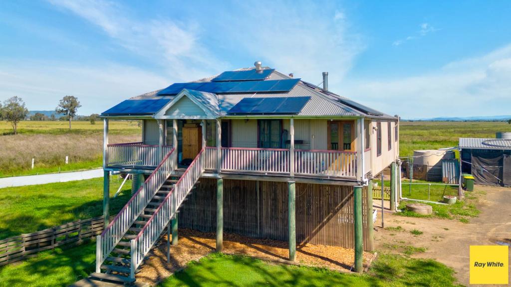
59 Kent Rd, Rifle Range is a 3 bedroom, 1 bathroom House with 2 parking spaces and was built in 1982. The property has a land size of 41550m2 and floor size of 134m2. While the property is not currently for sale or for rent, it was last sold in December 2016.
Last Listing description (March 2017)
This great acreage property is located at the end of a quiet no exit street only a few km from Lowood township which offers the best of country living with the convenience of a small town close by.
The renovated home has a beautiful kitchen containing a 90cm electric stove with easy cleaning ceramic cooktop and large multifunction oven perfect for easy cooking and for any size crowd when you are entertaining. Plenty of cupboards and bench space and room for a large fridge or pigeon pair fridge and freezer this has been well planned for any size family.
The air conditioned living area has cathedral style raked ceilings which give a feeling of space and allows for the breeze to blow through. The main living area is open plan so ideal for comfortable living.
The main bedroom has built-ins and a split system airconditioner and the other two bedrooms are large enough for queen sized beds if desired.
There is even a second toilet in the laundry which is a great convenience for any size family.
A lovely spacious 9x6m entertainment area with views over the property is located at the entry to the house. Sit here and enjoy the sunsets....perfect.
Outside there are sheds.....the main shed is 10m x 9m and the centre has a higher roller door so that you can easily store your horse float, boat or caravan.
There is also a 2 bay garage 6m x 9m with room for a work bench in the rear and adjoining this is a 2 bay carport.
Not only do you have this amazing storage but there is a 10x20 storage container with 4 doors for easy access and a 10x40 container if you are running short of space. There is even a generous sized garden shed for the mowing equipment or any other items.
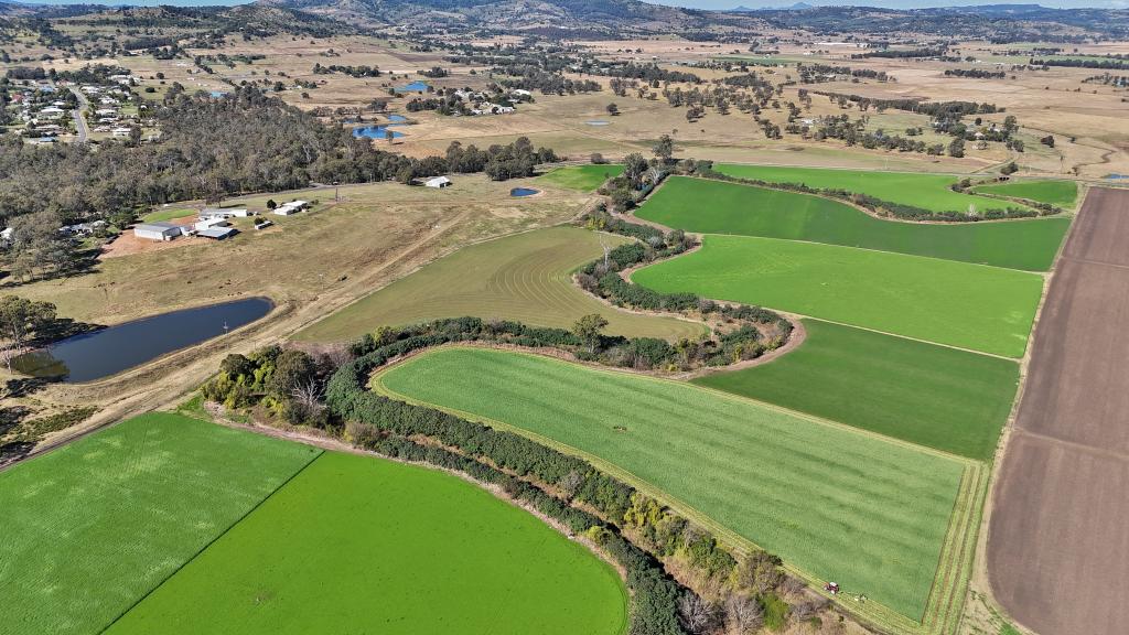
The acreage has a dam and is divided into 3 paddocks. Included is a 2 Megalitre water licence so that you can fill the dam in the dry times. Some work needs to be done to the water lines to bring this back into use.
This property has a 5KW solar system and also has provision for a generator to be attached to the power system if the power is lost at any time a great peace of mind back up.
There are 2 x 5000gal water tanks and 1 x 3000 water tank for water supply to the house so plenty for storage to keep you going even through the dry weather. There is also an additional 3000gal tank off the shed for garden watering or car washing ......you will be able to live as if you are on town water with this type of storage available.
This great property is only 1 hour from Brisbane airport, has the school bus at the end of the road and has easy access to the Warrego highway for travel to Brisbane or Toowoomba if you need to commute.
Lowood is only a few minutes away and has doctors, dentist a great IGA, bakery, hardware and cafes and pubs for entertainment. Atkinson and Wivehhoe dams are only approximately 15 minutes travel and offer great scenic activity areas and water sports.
Dont hesitate to book an appointment and see all this property has to offer.
Property History for 59 Kent Rd, Rifle Range, QLD 4311
- 09 Dec 2016Sold for $442,000
- 03 Nov 2016Listed for Sale Not Disclosed
- 30 Oct 1989Sold for $99,000
Commute Calculator
Recent sales nearby
See more recent sales nearbySimilar properties For Sale nearby
See more properties for sale nearbyAbout Rifle Range 4311
The size of Rifle Range is approximately 9.5 square kilometres. It has 1 park covering nearly 7% of total area. The population of Rifle Range in 2011 was 378 people. By 2016 the population was 181 showing a population decline of 52.1% in the area during that time. The predominant age group in Rifle Range is 40-49 years. Households in Rifle Range are primarily couples with children and are likely to be repaying $1400 - $1799 per month on mortgage repayments. In general, people in Rifle Range work in a community and personal service occupation. In 2011, 80.2% of the homes in Rifle Range were owner-occupied compared with 92.2% in 2016.
Rifle Range has 264 properties. Over the last 5 years, Houses in Rifle Range have seen a 148.02% increase in median value. As at 31 October 2024:
- The median value for Houses in Rifle Range is $773,520.
Suburb Insights for Rifle Range 4311
Market Insights
Rifle Range Trends for Houses
N/A
N/A
View TrendN/A
N/A
Rifle Range Trends for Units
N/A
N/A
View TrendN/A
N/A
Neighbourhood Insights
© Copyright 2024 RP Data Pty Ltd trading as CoreLogic Asia Pacific (CoreLogic). All rights reserved.


 0
0
/assets/perm/u5mfhyn6pii6nd6jd44imlkef4?signature=97f3264f5f8b0712b40e8c6ea115f4042b37a8b89dbb268e82eb08d3299cd6e8) 0
0 0
0
 0
0
 0
0

