138 Wyatts RoadRifle Range QLD 4311
Property Details for 138 Wyatts Rd, Rifle Range
Last Listing description (March 2021)
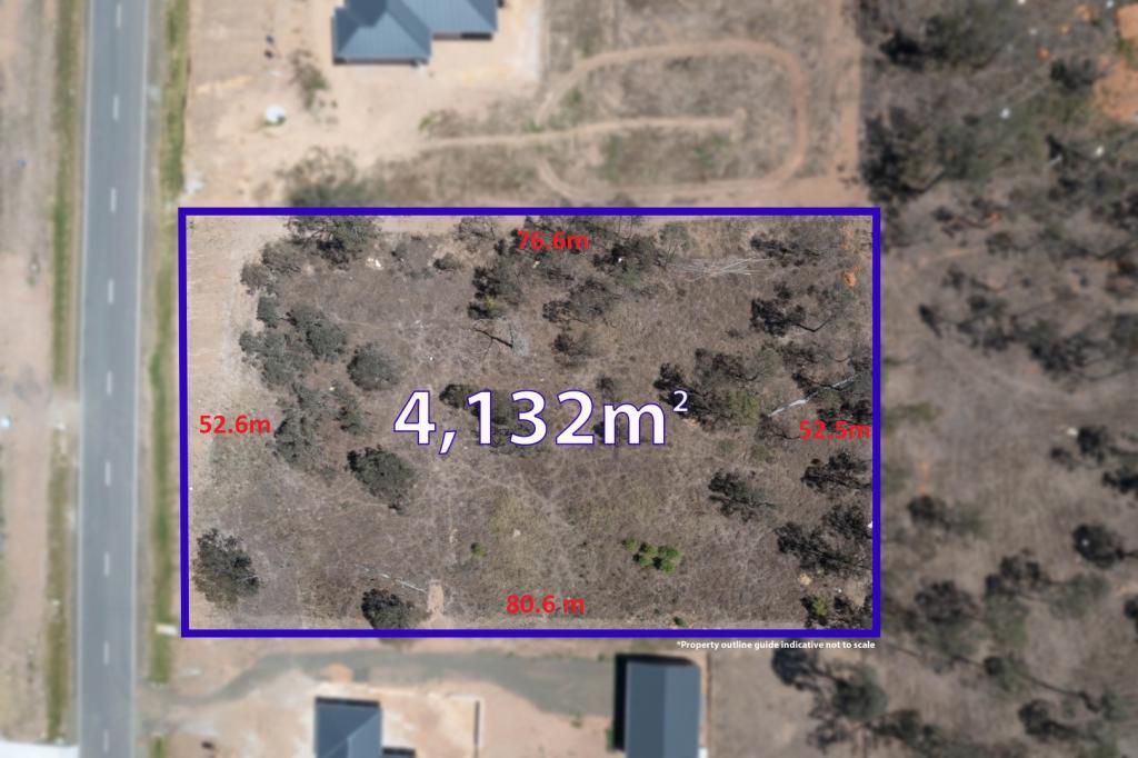
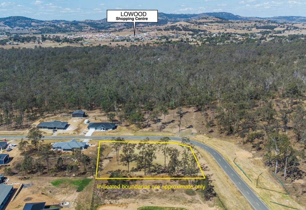
This gently sloping 10 acres is located only minutes from Lowood. It has established trees which gives it a bush block feel but with plenty of area that can be cleared for a house site.
There is an older shed with a previously lined area for a weekender but this is may need some work to be able to be reused or you can build your own.
There was power to the shed and a property pole is situated in the front corner of the property.
These acreage properties are not offered very often so give me a call and I would be happy to show you the property.
Property History for 138 Wyatts Rd, Rifle Range, QLD 4311
- 27 Jan 2021Sold for $240,000
- 14 Jan 2021Listed for Sale $240,000
- 26 Apr 1996Sold
Commute Calculator
Recent sales nearby
See more recent sales nearbySimilar properties For Sale nearby
See more properties for sale nearbySimilar properties For Rent nearby
See more properties for rent nearbyAbout Rifle Range 4311
The size of Rifle Range is approximately 9.5 square kilometres. It has 1 park covering nearly 7% of total area. The population of Rifle Range in 2011 was 378 people. By 2016 the population was 181 showing a population decline of 52.1% in the area during that time. The predominant age group in Rifle Range is 40-49 years. Households in Rifle Range are primarily couples with children and are likely to be repaying $1400 - $1799 per month on mortgage repayments. In general, people in Rifle Range work in a community and personal service occupation. In 2011, 80.2% of the homes in Rifle Range were owner-occupied compared with 92.2% in 2016.
Rifle Range has 264 properties. Over the last 5 years, Houses in Rifle Range have seen a 139.40% increase in median value. As at 30 September 2024:
- The median value for Houses in Rifle Range is $751,358.
Suburb Insights for Rifle Range 4311
Market Insights
Rifle Range Trends for Houses
N/A
N/A
View TrendN/A
N/A
Rifle Range Trends for Units
N/A
N/A
View TrendN/A
N/A
Neighbourhood Insights
© Copyright 2024 RP Data Pty Ltd trading as CoreLogic Asia Pacific (CoreLogic). All rights reserved.

 0
0

 0
0

 0
0
 0
0
 0
0
 0
0
 0
0
 0
0
