33 Rangewood DriveRangewood QLD 4817
Property Details for 33 Rangewood Dr, Rangewood
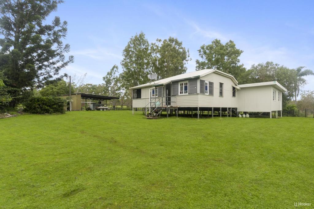
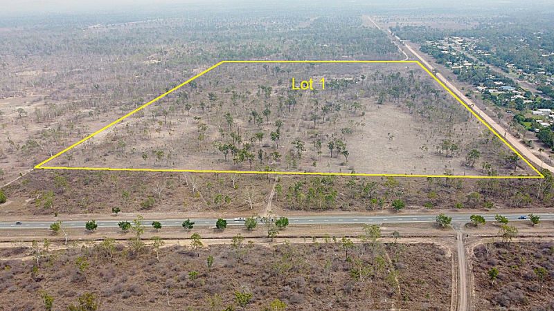
33 Rangewood Dr, Rangewood is a 3 bedroom, 1 bathroom House with 2 parking spaces. The property has a land size of 4588m2 and floor size of 124m2. While the property is not currently for sale or for rent, it was last sold in May 2023.
Last Listing description (January 2011)
RETURN TO MARKET - REDUCED PRICE!
Contract failed, Market price is now at little more that the cost of a good acreage block of land in Rangewood so call to view.
Features:
*3 split air-conditioners
*Kitchen
*Lounge
*Extra room- your choice of big bathroom or extra bedroom
*Aluminium insulated entertainment area
*Aluminium extension- electrical connection for future spa
*Shed with side double car port
*Garden shed
*Lots of established fruit trees, gardens
*Bore
*Irrigation
*Fully fenced
*4588 Sqm
Live in it as the previous owners have while you are renovating or live in it while you are building something else on this fantastic block and remove it after. (Check local authority if building new structure)
The present owners have moved out so currently empty. This is a big corner block with access from two streets.
The owners have instructed that all offers be presented so inspect to consider your options but this is priced to sell.
A copy of the Sustainability Declaration is available by contacting the office.
Property History for 33 Rangewood Dr, Rangewood, QLD 4817
- 24 May 2023Sold for $310,000
- 15 Mar 2011Sold for $280,000
- 22 Aug 2010Listed for Sale $317,000
Commute Calculator
Recent sales nearby
See more recent sales nearbyAbout Rangewood 4817
The size of Rangewood is approximately 21.2 square kilometres. It has 3 parks covering nearly 0.8% of total area. The population of Rangewood in 2011 was 1,083 people. By 2016 the population was 1,047 showing a population decline of 3.3% in the area during that time. The predominant age group in Rangewood is 50-59 years. Households in Rangewood are primarily couples with children and are likely to be repaying $1800 - $2399 per month on mortgage repayments. In general, people in Rangewood work in a trades occupation. In 2011, 91.8% of the homes in Rangewood were owner-occupied compared with 93.3% in 2016.
Rangewood has 408 properties. Over the last 5 years, Houses in Rangewood have seen a 63.79% increase in median value. As at 31 October 2024:
- The median value for Houses in Rangewood is $801,974 while the median value for Units is $382,902.
Suburb Insights for Rangewood 4817
Market Insights
Rangewood Trends for Houses
N/A
N/A
View TrendN/A
N/A
Rangewood Trends for Units
N/A
N/A
View TrendN/A
N/A
Neighbourhood Insights
© Copyright 2024 RP Data Pty Ltd trading as CoreLogic Asia Pacific (CoreLogic). All rights reserved.


 0
0
/assets/perm/vhxnir2lm4i65orp7gfdkh7fga?signature=36c225c83f0dcc3294dd6e07d608ab1d40dab12a69fc95eda0156ac814e78dfc) 0
0 0
0


