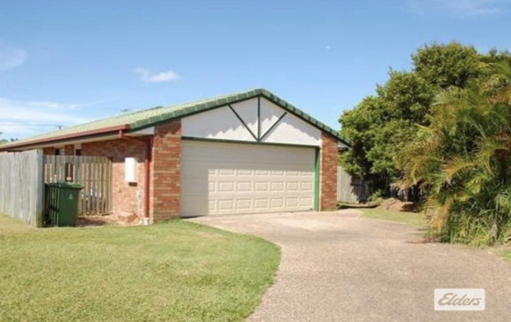
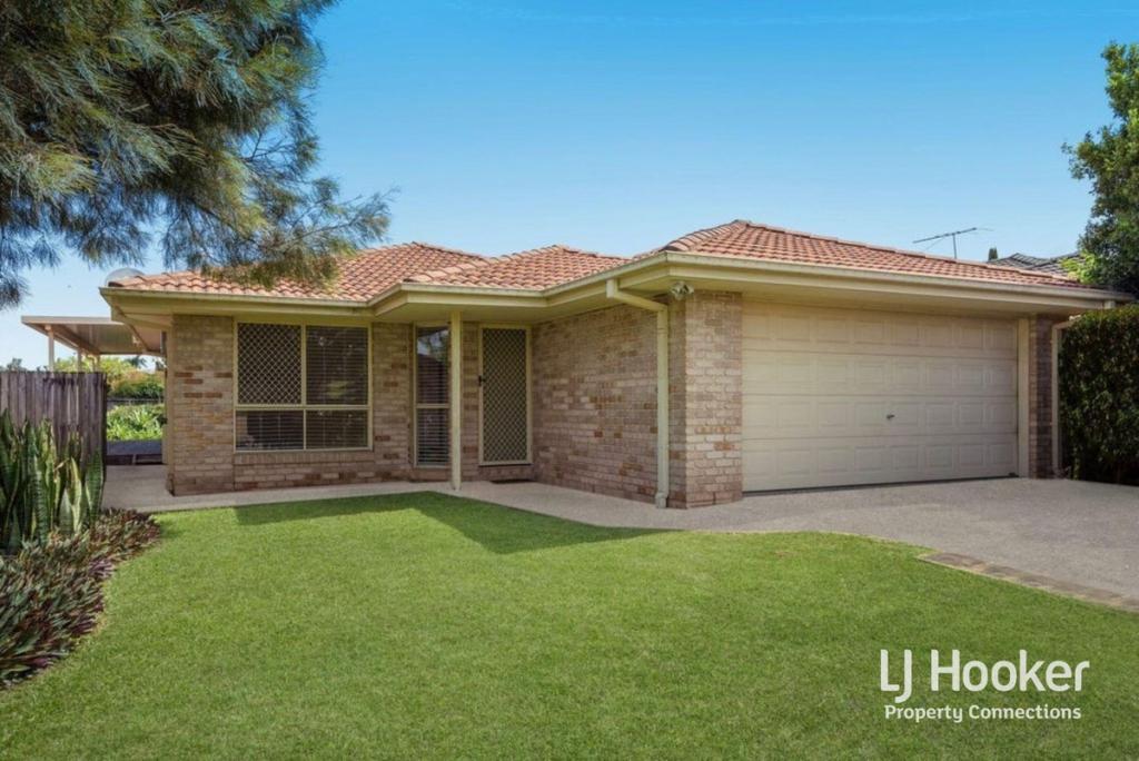
25 Freedom DriveKallangur QLD 4503
Property Details for 25 Freedom Dr, Kallangur
25 Freedom Dr, Kallangur is a 4 bedroom, 2 bathroom House with 2 parking spaces and was built in 1998. The property has a land size of 600m2. While the property is not currently for sale or for rent, it was last sold in November 2024. There are 106 other 4 bedroom Houses sold in Kallangur in the last 12 months.
Last Listing description (November 2024)
This home is set to appeal to a wide range of buyers in the current market conditions.
Don't miss the opportunity to make 25 Freedom Drive your new address!
This lovely low-set brick and tile home, perfectly balances comfort, convenience, and functionality. Situated on a 600 m2 block in a quiet street, this spacious family home is modern and stylish and boasts great value to home occupiers or astute investors.
It's currently lease at $540 pw to 16/11/2024.
Features:
• 4 good sized bedrooms, master bedroom with Ensuite.
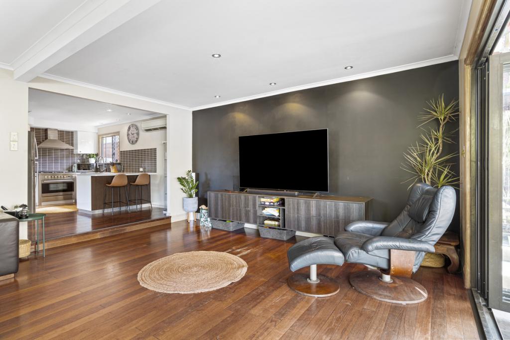
• Spacious open kitchen with electric appliances.
• Decent size lounge room.
• Separate dining area.
• Family bathroom with a shower and bathtub.
• Ceiling fans throughout.
• Air conditioning.
• Massive pergola perfect for entertainment.
• Fully fenced expansive backyard with side access.
• Security screens throughout.
• Remote garage door entry.
• Garden Shed.
Location:
• Walking distance to bus stops.
• 6 minutes drive to Dakabin Station.
• 9 minutes drive to North Lakes Westfield, Costco, Ikea.
• Easy access to Bruce Highway.
• Short distance to schools, shop and day-care centres.
Put 25 Freedom Drive on your Open Home list and discover the charm and convenience this property has to offer. Don't miss your chance to make this your new address!
Disclaimer – We have in preparing this information used our best endeavors to ensure that the information contained herein is true and accurate but accept no responsibility and disclaim all liability in respect of any errors, omissions, inaccuracies or misstatements that may occur. Prospective purchasers and rental tenants should make their own enquiries to verify the information contained herein.
Property History for 25 Freedom Dr, Kallangur, QLD 4503
- 21 Oct 2024Sold for $780,000
- 15 Oct 2024Listed for Sale Offers Over $750,000
- 18 Sep 2019Sold for $400,000
Recent sales nearby
See more recent sales nearbySimilar properties For Sale nearby
See more properties for sale nearby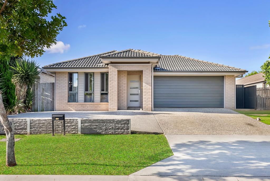

Similar properties For Rent nearby
See more properties for rent nearby
About Kallangur 4503
The size of Kallangur is approximately 11.3 square kilometres. It has 64 parks covering nearly 11% of total area. The population of Kallangur in 2011 was 18,982 people. By 2016 the population was 20,409 showing a population growth of 7.5% in the area during that time. The predominant age group in Kallangur is 0-9 years. Households in Kallangur are primarily couples with children and are likely to be repaying $1400 - $1799 per month on mortgage repayments. In general, people in Kallangur work in a trades occupation. In 2011, 62.7% of the homes in Kallangur were owner-occupied compared with 58.3% in 2016.
Kallangur has 9,701 properties. Over the last 5 years, Houses in Kallangur have seen a 83.82% increase in median value, while Units have seen a 98.69% increase. As at 28 February 2025:
- The median value for Houses in Kallangur is $762,010 while the median value for Units is $581,774.
- Houses have a median rent of $560 while Units have a median rent of $500.
What's around 25 Freedom Dr, Kallangur
25 Freedom Dr, Kallangur is in the school catchment zone for Kallangur State School and Dakabin State High School.


Suburb Insights for Kallangur 4503
Market Insights
Kallangur Trends for Houses
$762k
13.71%
View Trend$560/W
4.14%
Kallangur Trends for Units
$582k
21.87%
View Trend$500/W
4.83%
Neighbourhood Insights
Age
Population 20,409
0-9
16%
10-19
12%
20-29
15%
30-39
15%
40-49
13%
50-59
11%
60-69
10%
70-79
5%
80-89
2%
90-99
1%
Household Structure
Occupancy
© Copyright 2025 RP Data Pty Ltd trading as CoreLogic Asia Pacific (CoreLogic). All rights reserved.
This product uses cookies and other similar technologies to improve and customise your browsing experience, to tailor content and adverts, and for analytics and metrics regarding visitor usage on this product and other media. We may share cookie and analytics information with third parties for the purposes of advertising. By continuing to use our website, you consent to cookies being used. View our Privacy Policy here.
X