7 Droney RoadBroxburn QLD 4356
Property Details for 7 Droney Rd, Broxburn
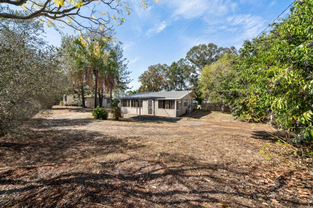
7 Droney Rd, Broxburn is a 3 bedroom, 1 bathroom House with 1 parking spaces and was built in 1960. The property has a land size of 20000m2 and floor size of 122m2. While the property is not currently for sale or for rent, it was last sold in June 2019.
Last Listing description (May 2019)
If your looking for a spot out of town, that's affordable to your budget and you don't mind doing some work, this property is for you.
Solid besser block, 3 bedroom home, spacious lounge with both air conditioning and wood heating, bathroom has shower, vanity and linen cupboard. Single carport and a verandah along the north and eastern side of the home. Power connected, garbage service available.
You can move in now, or before you do, paint - add new floor coverings, add a rainwater tank, maybe a kitchen and bathroom but neither are necessary immediately.
Great opportunity to pick up a few acres, just 4.2km from the Southbrook Community, 9.5km to Pittsworth and 34kms to Toowoomba. Turn right off the Southbrook Felton Road, and this little gem is about 55m to the gate way.
Property History for 7 Droney Rd, Broxburn, QLD 4356
- 06 Jun 2019Sold for $250,000
- 08 Apr 2019Listed for Sale $265,000 Negotiable
Commute Calculator
Recent sales nearby
See more recent sales nearbyAbout Broxburn 4356
The size of Broxburn is approximately 31.9 square kilometres. The population of Broxburn in 2011 was 246 people. By 2016 the population was 154 showing a population decline of 37.4% in the area during that time. The predominant age group in Broxburn is 40-49 years. Households in Broxburn are primarily childless couples and are likely to be repaying $1400 - $1799 per month on mortgage repayments. In general, people in Broxburn work in a managers occupation. In 2011, 71.5% of the homes in Broxburn were owner-occupied compared with 75.5% in 2016..
Broxburn has 48 properties. Over the last 5 years, Houses in Broxburn have seen a 128.93% increase in median value. As at 31 October 2024:
- The median value for Houses in Broxburn is $866,937.
Suburb Insights for Broxburn 4356
Market Insights
Broxburn Trends for Houses
N/A
N/A
View TrendN/A
N/A
Broxburn Trends for Units
N/A
N/A
View TrendN/A
N/A
Neighbourhood Insights
© Copyright 2024 RP Data Pty Ltd trading as CoreLogic Asia Pacific (CoreLogic). All rights reserved.


 0
0


