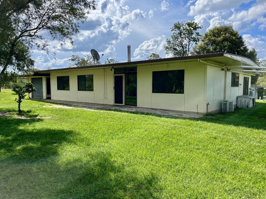
4225 Bungawalbin Whiporie RoadWhiporie NSW 2469
Property Details for 4225 Bungawalbin Whiporie Rd, Whiporie
Last Listing description (March 2023)
* Set on 16.05 ha or just under 40 acres this block has clear flat mainly arable country with boundary fencing on main paddock and 2 internals.
* A few acres of forrest accross the road with Myall Creek at the boundary.
* National Park on the Eastern boundary.
* Small cabin setup with adjioning caravan, kitchen, and basic bathroom.
* Small solar system, 5 panels, open bay shed, 2 spring fed dams.
* 5 minute drive to Whiporie village , Grafton in 50 kms and the Evans Head beaches, 60 kms via Bungawalbin Whiporie rd which comes out just shy of Woodburn, or Richmond River fishing.
* Agent discloses bush fires in the area in 2019, please note container not included, small disused rd on property, price is firm.
Please Note - The current owner is purchasing at his cost an old disused road owned by a neighbour , and will be registered in the new owners name, which will add around 1 hectare to the property size.
Property History for 4225 Bungawalbin Whiporie Rd, Whiporie, NSW 2469
- 14 Oct 2022Listed for Sale $355,000
- 03 Apr 2020Listed for Sale $240,000
- 21 May 2009Sold for $71,000
Commute Calculator
About Whiporie 2469
The size of Whiporie is approximately 107.4 square kilometres. It has 6 parks covering nearly 53.4% of total area. The population of Whiporie in 2011 was 235 people. By 2016 the population was 56 showing a population decline of 76.2% in the area during that time. The predominant age group in Whiporie is 50-59 years. Households in Whiporie are primarily childless couples and are likely to be repaying $1000 - $1399 per month on mortgage repayments. In general, people in Whiporie work in a professional occupation. In 2011, 79% of the homes in Whiporie were owner-occupied compared with 83.3% in 2016..
Whiporie has 62 properties. As at 30 November 2024:
- The median value for Houses in Whiporie is $355,754.
Suburb Insights for Whiporie 2469
Market Insights
Whiporie Trends for Houses
N/A
N/A
View TrendN/A
N/A
Whiporie Trends for Units
N/A
N/A
View TrendN/A
N/A
Neighbourhood Insights
© Copyright 2024 RP Data Pty Ltd trading as CoreLogic Asia Pacific (CoreLogic). All rights reserved.

 0
0

