OFF MARKET
Are you the owner?

9/11 Pacific Highway
Wahroonga NSW 2076

Bedrooms: 3
Bathrooms: 1
Car spaces: -
Floor area: 88m2
Land area: 1050m2
Estimated Value & Rent
Estimated Value
Estimated Rent
High Confidence
Last updated 10 Mar 2025
Low

High
$650k
$700k
Save

Property Details for 9/11 Pacific Hwy, Wahroonga

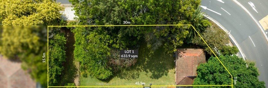
9/11 Pacific Hwy, Wahroonga is a 3 bedroom, 1 bathroom Unit and was built in 1964. The property has a land size of 1050m2 and floor size of 88m2. While the property is not currently for sale or for rent, it was last sold in August 2022.

Building Type
Unit
Year Built
1964
Floor Size
88m2
Land Size
1050m2
Local Government
Hornsby
Lot/Plan
9/SP984

Last Listing description (March 2024)

For easy access for viewings, park on Anulla Place and walk through the walkway to the pacific highway and turn left.

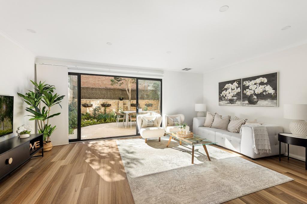
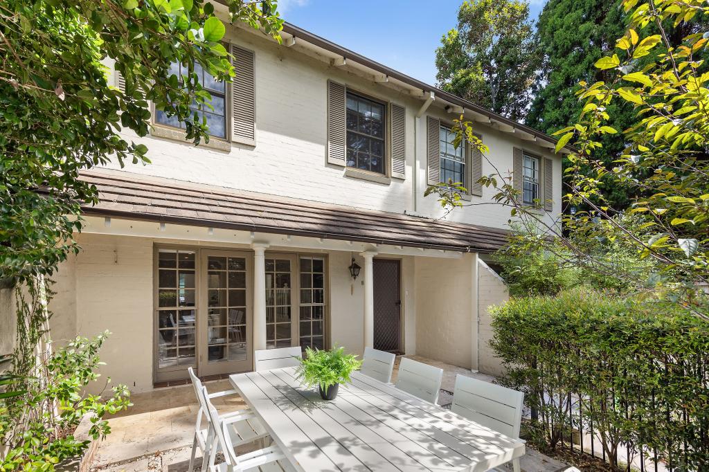
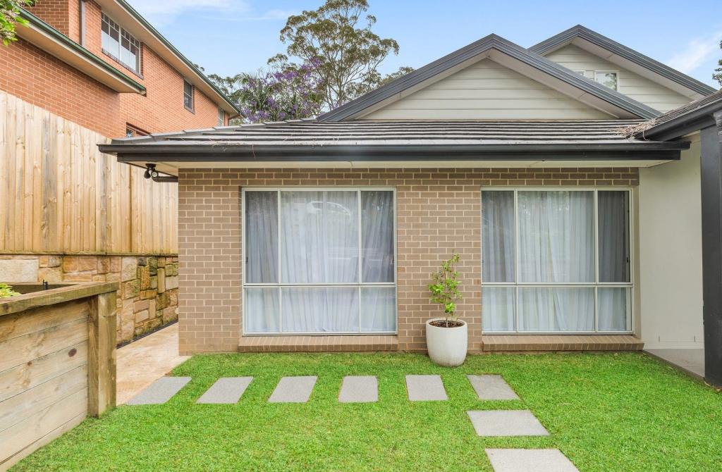
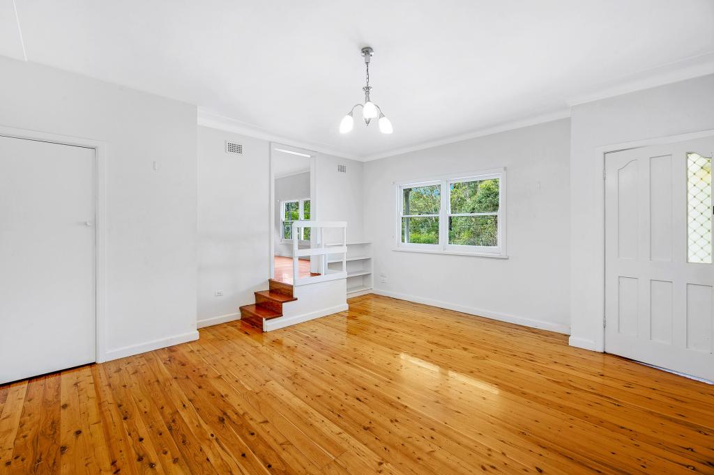
This beautiful presented solid double brick two bedroom plus study unit has large rooms, high ceilings, and loads of natural light. Located just past Pearce's Corner, the unit is beautifully presented with a new bathroom, new appliances in the kitchen, and floorboard throughout. The large open plan living/dining room opens onto the balcony which has a lovely leafy outlook, facing northeast and both bedrooms have built-in wardrobes and air conditioning. There is a single lock-up garage with internal security access, plus a generous storeroom.

- Modern kitchen with electric cooking appliances

- Both bedrooms separated from the living area
- Study room which could double up as a third bedroom with direct access to balcony
- Air-conditioning & fans in lounge and bedrooms
- Well appointed & spacious bathroom with shower over bath
- Security block with intercom; only 12 units in the complex
- Lock-up garage that extends into a massive storage area
- Walking distance to Wahroonga or Waitara railway stations
- Close to shops, schools, parks and all local amenities; Waitara Public School catchment

Property History for 9/11 Pacific Hwy, Wahroonga, NSW 2076

A timeline of how this property has performed in the market
Last Sold
$650,000
22 Aug 2022
Listed for Rent
$395/w
04 Dec 2012
  • 24 Jan 2024
    Listed for Rent $600 / week
  • 22 Aug 2022
    Sold for $650,000
  • 29 Mar 2022
    Listed for Sale $650,000
Sign in to see more transactions

Commute Calculator

Where to?
-
-
-
-

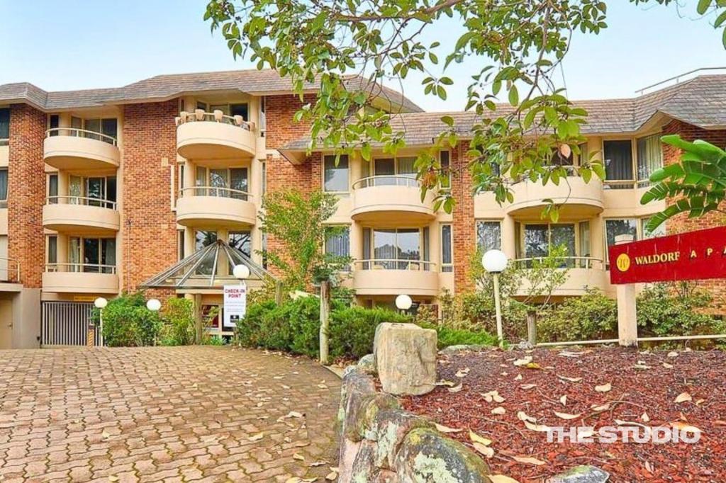
About Wahroonga 2076

The size of Wahroonga is approximately 9.7 square kilometres. It has 36 parks covering nearly 13.3% of total area. The population of Wahroonga in 2011 was 16,725 people. By 2016 the population was 17,348 showing a population growth of 3.7% in the area during that time. The predominant age group in Wahroonga is 10-19 years. Households in Wahroonga are primarily couples with children and are likely to be repaying over $4000 per month on mortgage repayments. In general, people in Wahroonga work in a professional occupation. In 2011, 80.3% of the homes in Wahroonga were owner-occupied compared with 80.6% in 2016.

Wahroonga has 7,329 properties. Over the last 5 years, Houses in Wahroonga have seen a 37.37% increase in median value, while Units have seen a 21.97% increase. As at 28 February 2025:

  • The median value for Houses in Wahroonga is $2,830,952 while the median value for Units is $1,063,062.
  • Houses have a median rent of $1,180 while Units have a median rent of $700.
There are currently 49 properties listed for sale, and 20 properties listed for rent in Wahroonga on OnTheHouse. According to CoreLogic's data, 296 properties were sold in the past 12 months in Wahroonga.

What's around 9/11 Pacific Hwy, Wahroonga

Nearby Schools
Comparable Properties
Abbotsleigh
0.4km
Wahroonga 2076
CombinedNon-GovernmentP - 12Combined1420 Enrolled
St Leo's Catholic College
0.42km
Wahroonga 2076
SecondaryNon-Government7 - 12Combined801 Enrolled
Abbotsleigh Junior School
0.46km
Wahroonga 2076
PrimaryNon-GovernmentCombined Enrolled
Knox Grammar School - Wahroonga Preparatory Campus
0.67km
Wahroonga 2076
PrimaryNon-GovernmentCombined Enrolled
Normanhurst Boys High School
0.75km
Normanhurst 2076
SecondaryGovernment7 - 12Combined756 Enrolled
Barker College Junior School
0.76km
Address not found
PrimaryNon-GovernmentCombined Enrolled
Loreto Normanhurst
0.77km
Normanhurst 2076
CombinedNon-Government5 - 12Combined1083 Enrolled
Wahroonga Preparatory School
0.88km
61 COONANBARRA RD Wahroonga 2076
PrimaryNon-Government1 - 6Combined92 Enrolled
Waitara Public School
1.04km
Wahroonga 2076
PrimaryGovernmentP - 6Combined862 Enrolled
Knox Grammar School
1.13km
Wahroonga 2076
SecondaryNon-GovernmentP - 12Combined2890 Enrolled

Suburb Insights for Wahroonga 2076

Market Insights
Wahroonga Trends for Houses
Median Value

$2.83M

0.23%
View Trend
Median Growth

3.22%

View Trend
Median Rent

$1.18k/W

7.27%
View Trend
Rental Yield

2.15%

1.90%
View Trend
Median Value: The middle value of all properties across the geography based on the Automated Valuation Model.


Median Value over 1 year (03/24 - 02/25)
Wahroonga Trends for Units
Median Value

$1.06M

2.69%
View Trend
Median Growth

2.56%

View Trend
Median Rent

$700/W

1.45%
View Trend
Rental Yield

3.82%

4.95%
View Trend
Median Value: The middle value of all properties across the geography based on the Automated Valuation Model.


Median Value over 1 year (03/24 - 02/25)
Neighbourhood Insights
Age

Population 17,348

0-9


12%

10-19


17%

20-29


9%

30-39


10%

40-49


15%

50-59


14%

60-69


10%

70-79


7%

80-89


5%

90-99


2%

Household Structure
Occupancy
Disclaimer
Whilst all reasonable effort is made to ensure the information in this publication is current, CoreLogic does not warrant the accuracy or completeness of the data and information contained in this publication and to the full extent not prohibited by law excludes all liability for any loss or damage arising in connection with the data and information contained in this publication.
New South Wales data
Contains property sales information provided under licence from the Valuer General New South Wales. RP Data Pty Ltd trading as CoreLogic Asia Pacific is authorised as a Property Sales Information provider by the Valuer General New South Wales.
Valuations and Estimates
This estimate is provided by CoreLogic, and is based on statistical market data such as recent local sales, property size, number of bedrooms and many more factors. It comes from public data, which may be incomplete or inaccurate, and should not be used in lieu of a professional appraisal under any circumstances, including for lending purposes or in home loan applications.
School data and Content
Product Data licenced by CoreLogic under a Creative Commons Attribution licence. For details regarding licence, data source, copyright and disclaimers, see https://www.corelogic.com.au/legals/third-party-restrictions
ABS data
This publication contains data and statistics provided by the Australian Bureau of Statistics, available at http://www.abs.gov.au/ and reproduced under Creative Commons Attribution 2.5 http://creativecommons.org/licenses/by/2.5/au/legalcode
Liveability information
The Liveability Score is a rating (out of 10) provided by Propella.ai Pty Ltd as a guide about how "well-connected" properties are in certain local areas. The Liveability Score is based on statistical data about a local area in which a property is located including the distance to and number of available facilities and services (including schools, parklands, health services, shopping and public transport) (Liveability Data). The Liveability Data and Liveability Score has not been verified or confirmed by CoreLogic, is not available for all properties, and is of a general nature and should not be construed as specific advice or relied upon in lieu of appropriate professional advice. Given the relative nature of the Liveability Score, propella.ai anticipate that scores for individual properties will change over time.