433 St Albans RoadLower Macdonald NSW 2775
Property Details for 433 St Albans Rd, Lower Macdonald
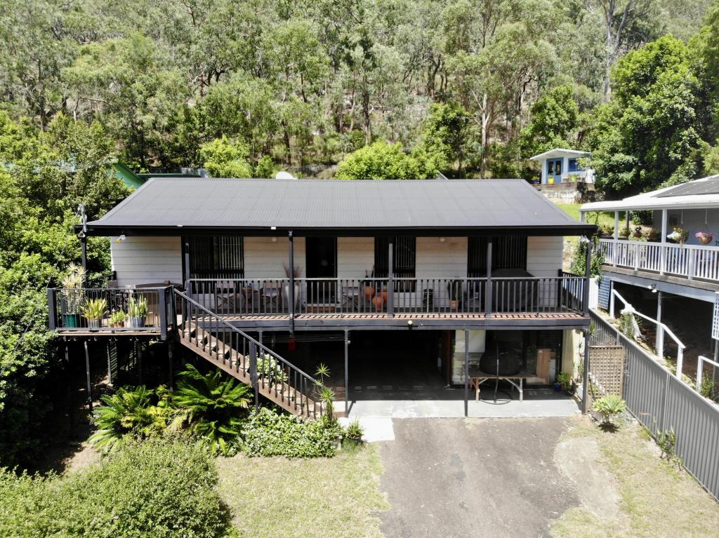
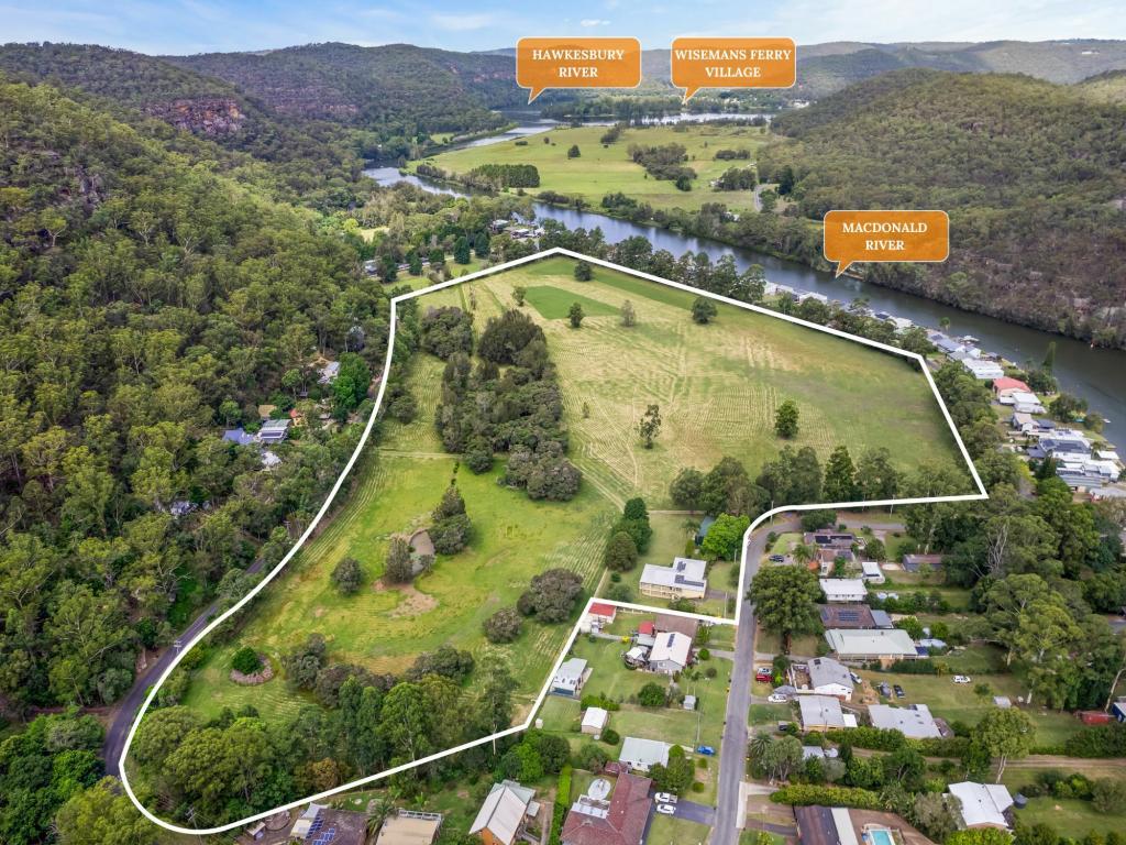
433 St Albans Rd, Lower Macdonald is a 2 bedroom, 1 bathroom House and was built in 1984. The property has a land size of 140600m2 and floor size of 124m2. While the property is not currently for sale or for rent, it was last sold in May 2021.
Last Listing description (September 2016)
This is a magnificent bushland block with great natural outcrops of rock and unspoiled forest. There is however a nice area of about an acre or so which could be developed for garden and lawns; the rest is for privacy and adventure. Situated in this area, accessible along 'your own dirt track', and private from the road is the quirky barn style slab and stone house. It doesn't conform with current council standards, but hey; this is the Macdonald Valley!! It's different, it needs some work, but the basics are all there. Rather than me trying to describe it, check the photos.
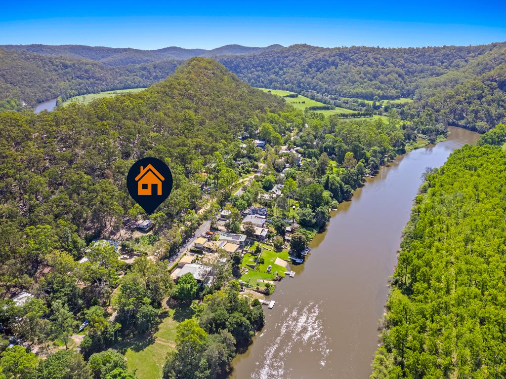
This is only 3 minutes across Webb's Ferry and is on sealed road, bus to school, power, phone, ADSL.
Never will you find a better place to start than here. Give me a call and I'll show you through. It is currently tenanted to October this year. So give me a day or two notice if you can.
Property History for 433 St Albans Rd, Lower Macdonald, NSW 2775
- 01 May 2021Sold for $250,000
- 30 Jun 2016Sold for $370,000
- 16 May 2016Listed for Sale NOW SOLD@ $370,000
Commute Calculator
Recent sales nearby
See more recent sales nearbySimilar properties For Sale nearby
See more properties for sale nearbyAbout Lower Macdonald 2775
The size of Lower Macdonald is approximately 10.6 square kilometres. It has 4 parks covering nearly 81.9% of total area. The population of Lower Macdonald in 2011 was 262 people. By 2016 the population was 249 showing a population decline of 5.0% in the area during that time. The predominant age group in Lower Macdonald is 40-49 years. Households in Lower Macdonald are primarily childless couples and are likely to be repaying $1400 - $1799 per month on mortgage repayments. In general, people in Lower Macdonald work in a trades occupation. In 2011, 73.9% of the homes in Lower Macdonald were owner-occupied compared with 75.9% in 2016.
Lower Macdonald has 259 properties. Over the last 5 years, Houses in Lower Macdonald have seen a 29.44% increase in median value. As at 28 February 2025:
- The median value for Houses in Lower Macdonald is $640,139 while the median value for Units is $610,876.
- Houses have a median rent of $318.
Suburb Insights for Lower Macdonald 2775
Market Insights
Lower Macdonald Trends for Houses
N/A
N/A
View TrendN/A
N/A
Lower Macdonald Trends for Units
N/A
N/A
View TrendN/A
N/A
Neighbourhood Insights
© Copyright 2025 RP Data Pty Ltd trading as CoreLogic Asia Pacific (CoreLogic). All rights reserved.


/assets/perm/jy4be6euxui6zf7e5gsq6algai?signature=aa73feb8e8a223d03ab566157363c357e2eced2f679a7bf32b65e39f5ee7deaf) 0
0
 0
0 0
0 0
0
