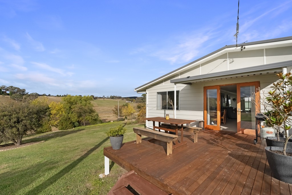
SOLD
Are you the owner?
Sold on 31 Jul 2024 - Price Unavailable

99 Kanimbla Drive
Kanimbla NSW 2790

Bedrooms: -
Bathrooms: -
Car spaces: -
Land area: 106223m2
Save

Property Details for 99 Kanimbla Dr, Kanimbla

Building Type
Unknown
Land Size
106223m2
Local Government
Lithgow City
Lot/Plan
4/DP251246

Property History for 99 Kanimbla Dr, Kanimbla, NSW 2790

A timeline of how this property has performed in the market
Last Sold
31 Jul 2024
  • 31 Jul 2024
    Sold

Commute Calculator

-
-
-
-

About Kanimbla 2790

The size of Kanimbla is approximately 59.4 square kilometres. It has 3 parks. The population of Kanimbla in 2011 was 262 people. By 2016 the population was 125 showing a population decline of 52.3% in the area during that time. The predominant age group in Kanimbla is 50-59 years. Households in Kanimbla are primarily childless couples and are likely to be repaying $1800 - $2399 per month on mortgage repayments. In general, people in Kanimbla work in a professional occupation. In 2011, 82.1% of the homes in Kanimbla were owner-occupied compared with 88.1% in 2016.

Kanimbla has 153 properties. Over the last 5 years, Houses in Kanimbla have seen a 64.52% increase in median value. As at 31 December 2024:

  • The median value for Houses in Kanimbla is $1,185,434.
There are currently 1 property listed for sale, and no properties listed for rent in Kanimbla on OnTheHouse. According to CoreLogic's data, 6 properties were sold in the past 12 months in Kanimbla.

What's around 99 Kanimbla Dr, Kanimbla

99 Kanimbla Dr, Kanimbla is in the school catchment zone for Hampton Public School and Lithgow High School.

Nearby Schools
Comparable Properties
Mount Victoria Public School
8.4km
Mount Victoria 2786
PrimaryGovernmentP - 6Combined61 Enrolled
OneSchool Global, Mount Victoria campus
8.47km
Mount Victoria 2786
CombinedNon-GovernmentCombined Enrolled
Mountains Christian College
9.65km
Blackheath 2785
CombinedNon-GovernmentP - 12Combined191 Enrolled
Blackheath Public School
10.4km
Blackheath 2785
PrimaryGovernmentP - 6Combined333 Enrolled
Megalong Public School
11.05km
Megalong Valley 2785
PrimaryGovernmentP - 6Combined13 Enrolled
Hampton Public School
11.74km
Hampton 2790
IN CATCHMENTPrimaryGovernmentP - 6Combined6 Enrolled
Scots All Saints College, Lithgow Campus
14.7km
Address not found
PrimaryNon-GovernmentCombined Enrolled
La Salle Academy
15.03km
Littleton 2790
SecondaryNon-Government7 - 12Combined237 Enrolled
Katoomba North Public School
15.28km
Katoomba 2780
PrimaryGovernmentP - 6Combined134 Enrolled
Lithgow High School
15.69km
Lithgow 2790
IN CATCHMENTSecondaryGovernment7 - 12Combined782 Enrolled

Suburb Insights for Kanimbla 2790

Market Insights
Kanimbla Trends for Houses
Median Value

$1.19M

1.05%
View Trend
Median Growth

4.47%

View Trend
Median Rent

N/A

-
View Trend
Rental Yield

2.38%

3.48%
View Trend
Median Value: The middle value of all properties across the geography based on the Automated Valuation Model.


Median Value over 1 year (01/24 - 12/24)
Kanimbla Trends for Units
Median Value

N/A

-
View Trend
Median Growth

N/A

View Trend
Median Rent

N/A

-
View Trend
Rental Yield

N/A

-
View Trend
Median Value: The middle value of all properties across the geography based on the Automated Valuation Model.


Median Value over 1 year
Neighbourhood Insights
Age

Population 125

0-9


4%

10-19


3%

20-29


6%

40-49


22%

50-59


33%

60-69


16%

70-79


21%

Household Structure
Occupancy
Disclaimer
Whilst all reasonable effort is made to ensure the information in this publication is current, CoreLogic does not warrant the accuracy or completeness of the data and information contained in this publication and to the full extent not prohibited by law excludes all for any loss or damage arising in connection with the data and information contained in this publication.
New South Wales data
Contains property sales information provided under licence from the Valuer General New South Wales. RP Data Pty Ltd trading as CoreLogic Asia Pacific is authorised as a Property Sales Information provider by the Valuer General New South Wales.
Valuations and Estimates
This estimate is provided by CoreLogic, and is based on statistical market data such as recent local sales, property size, number of bedrooms and many more factors. It comes from public data, which may be incomplete or inaccurate, and should not be used in lieu of a professional appraisal under any circumstances, including for lending purposes or in home loan applications.
School data and Content
Product Data licenced by CoreLogic under a Creative Commons Attribution licence. For details regarding licence, data source, copyright and disclaimers, see https://www.corelogic.com.au/legals/third-party-restrictions
ABS data
This publication contains data and statistics provided by the Australian Bureau of Statistics, available at http://www.abs.gov.au/ and reproduced under Creative Commons Attribution 2.5 http://creativecommons.org/licenses/by/2.5/au/legalcode
Liveability information
The Liveability Score is a rating (out of 10) provided by Propella.ai Pty Ltd as a guide about how "well-connected" properties are in certain local areas. The Liveability Score is based on statistical data about a local area in which a property is located including the distance to and number of available facilities and services (including schools, parklands, health services, shopping and public transport) (Liveability Data). The Liveability Data and Liveability Score has not been verified or confirmed by CoreLogic, is not available for all properties, and is of a general nature and should not be construed as specific advice or relied upon in lieu of appropriate professional advice. Given the relative nature of the Liveability Score, propella.ai anticipate that scores for individual properties will change over time.