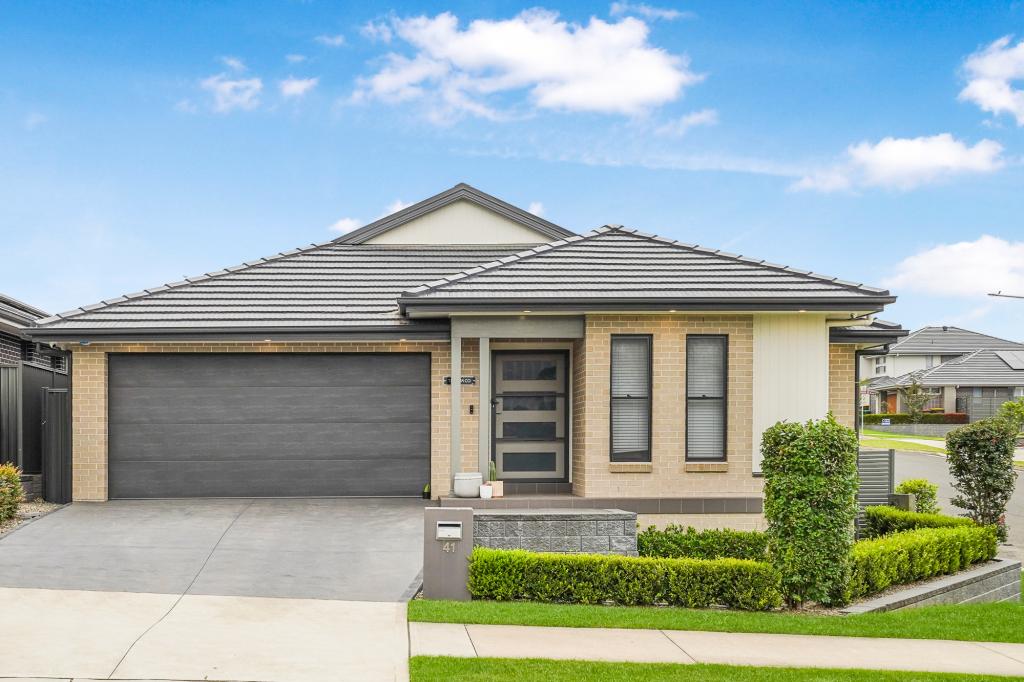
77 Nineteenth StreetWarragamba NSW 2752

Property Details for 77 Nineteenth St, Warragamba
77 Nineteenth St, Warragamba is a 3 bedroom, 2 bathroom House with 3 parking spaces. The property has a land size of 962.5m2. While the property is not currently for sale or for rent, it was last sold in December 2024. There are other 3 bedroom House sold in Warragamba in the last 12 months.
Last Listing description (December 2024)
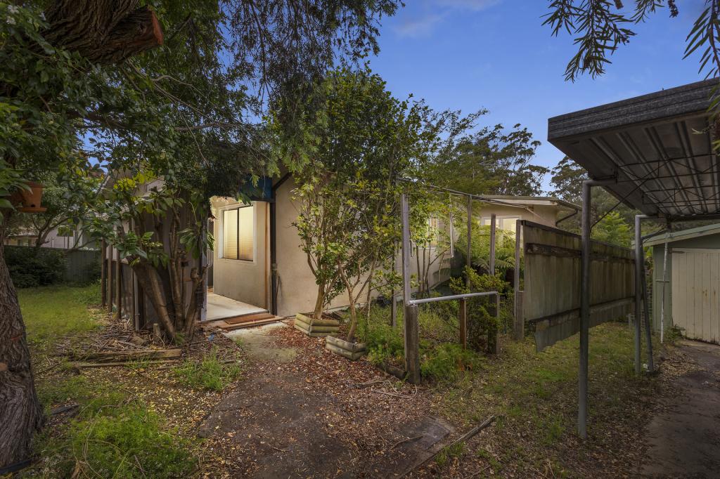
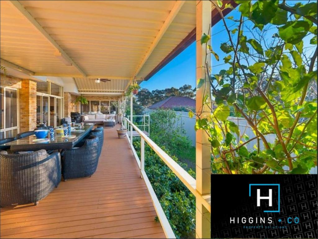
Welcome to your ideal family home! This charming three-bedroom, two-bathroom residence is set on a spacious corner block of approximately 962.5m², offering ample room for relaxation and entertainment.
Enjoy three versatile living areas, perfect for family gatherings or quiet evenings. Step outside to your private pool, an oasis for summer fun. Conveniently located near schools, shops, and public transport, this home combines comfort with accessibility with plenty of outdoor space for children and pets to play, this property is a must-see.
- Three spacious bedrooms
- Multiple living areas across the home
- Ample natural light throughout
- Versatile floor plan that allows for the growing family
- Ample storage space underneath the home with drive-way access off Eighteenth Street
- Prime position within Warragamba
- Approx. 962.5sqm corner block
- Large in ground pool
- Solar panels
- Additional carport for storage
For more information, please contact Aimee Mitchell on 0402 482 114.
Disclaimer: Whilst we deem this information to be reliable the agent cannot guarantee its accuracy and accepts no responsibility for such. Interested persons should rely on their own enquiries.
Property History for 77 Nineteenth St, Warragamba, NSW 2752
- 18 Dec 2024Sold for $1,000,000
- 11 Oct 2024Listed for Sale $1,000,000
- 08 Nov 2020Sold for $650,000
Recent sales nearby
See more recent sales nearbySimilar properties For Sale nearby
See more properties for sale nearby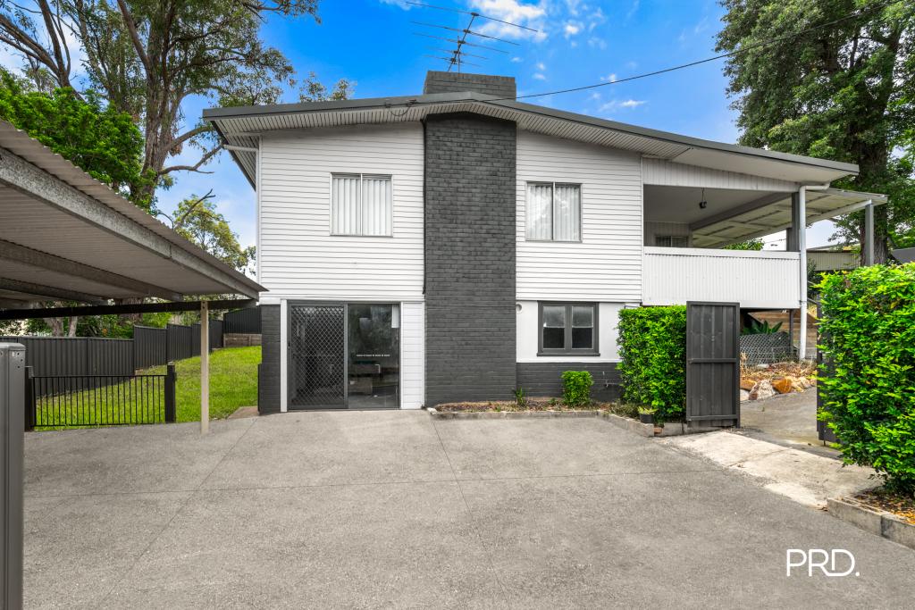

Similar properties For Rent nearby
See more properties for rent nearby
About Warragamba 2752
The size of Warragamba is approximately 5.3 square kilometres. It has 10 parks covering nearly 24.8% of total area. The population of Warragamba in 2011 was 1,234 people. By 2016 the population was 1,226 showing a population decline of 0.6% in the area during that time. The predominant age group in Warragamba is 50-59 years. Households in Warragamba are primarily couples with children and are likely to be repaying $1400 - $1799 per month on mortgage repayments. In general, people in Warragamba work in a trades occupation. In 2011, 75.2% of the homes in Warragamba were owner-occupied compared with 76.9% in 2016.
Warragamba has 623 properties. Over the last 5 years, Houses in Warragamba have seen a 67.41% increase in median value, while Units have seen a 36.41% increase. As at 28 February 2025:
- The median value for Houses in Warragamba is $803,315 while the median value for Units is $382,577.
- Houses have a median rent of $550.
What's around 77 Nineteenth St, Warragamba
77 Nineteenth St, Warragamba is in the school catchment zone for Warragamba Public School and Glenmore Park High School.


Suburb Insights for Warragamba 2752
Market Insights
Warragamba Trends for Houses
N/A
N/A
View TrendN/A
N/A
Warragamba Trends for Units
N/A
N/A
View TrendN/A
N/A
Neighbourhood Insights
Age
Population 1,226
0-9
13%
10-19
14%
20-29
13%
30-39
14%
40-49
12%
50-59
14%
60-69
11%
70-79
6%
80-89
2%
90-99
1%
Household Structure
Occupancy
© Copyright 2025 RP Data Pty Ltd trading as CoreLogic Asia Pacific (CoreLogic). All rights reserved.
This product uses cookies and other similar technologies to improve and customise your browsing experience, to tailor content and adverts, and for analytics and metrics regarding visitor usage on this product and other media. We may share cookie and analytics information with third parties for the purposes of advertising. By continuing to use our website, you consent to cookies being used. View our Privacy Policy here.
X